


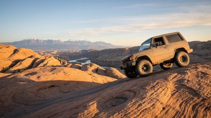

Quick Verdict: The best off road trails in Utah start on Moab’s slickrock domes. Then they finish on a 90-mile permit loop inside Canyonlands National Park. For a first trip, Gemini Bridges and the Sand Hollow West Rim ask the least of a stock 4×4. Hell’s Revenge and Pritchett Canyon sit at the hard end, where lockers stop being optional. In addition, every trail below carries a custom topo map with mile markers and a USGS elevation profile.
Last updated: July 2026 | 16 min read | Part of our Best Off-Road Trails by State series, after California.
Conditions alert, July 2026: The National Park Service closed Shafer Trail Road on July 20, 2026 after flood damage. So far, no reopening date is set. Grand View Point and part of the Island in the Sky park road also close Monday through Thursday, July 27 to October 1. Stage 2 fire restrictions cover Canyonlands and Sand Hollow State Park, so only propane and liquid-fuel stoves are legal. Check agency pages before every trip.
In This Guide
- How We Picked the Best Off Road Trails in Utah
- All 11 Trails at a Glance
- Moab: Slickrock, Sand Flats and Behind the Rocks
- Canyonlands National Park: Permit Country
- Wider Utah: Sand Hollow and the San Rafael Swell
- Side-by-Sides and Non-Street-Legal Rigs
- Desert Logistics: Fuel, Water and Recovery
- Pros and Cons of Wheeling Utah
- Which Off Road Trails in Utah Fit Your Rig?
- Final Verdict
- Frequently Asked Questions
How We Picked the Best Off Road Trails in Utah
We weighed notoriety, terrain variety, difficulty spread and legal access, then cut the field to 11. Six picks sit around Moab, because Moab earns the concentration. Meanwhile, the rest reach north to the San Rafael Swell and southwest to the dunes above St. George.
This guide is research-based rather than a trip report. In fact, our team has no seat time in Utah. Instead, every mile, rating and rule below traces to an agency page, a published report or our own GPS measurement. In short, naming the source beats inventing field detail.
Each entry includes one of 11 custom maps built from OpenStreetMap route geometry and USGS 3DEP elevation data. After all, a pretty graphic is worthless if the numbers are wrong. So all 11 get GPS-measured mileage, mile markers and a profile in feet. Where our mileage disagrees with a published figure, we say so in the trail entry. Likewise, difficulty labels are ours, cross-checked against agency wording and published guides where either exists. New to rating systems? Our guide on how to navigate off-road trails like a pro explains the symbols first.
All 11 Trails at a Glance
| Trail | Mapped Miles | Elevation (ft) | Difficulty | Region |
|---|---|---|---|---|
| Hell’s Revenge | 6.8 | 4,463–4,767 | Difficult, slickrock | Sand Flats, Moab |
| Fins n Things | 9.3 | 4,532–5,090 | Moderate to difficult | Sand Flats, Moab |
| Poison Spider Mesa | 7.9 one way | 3,970–5,048 | Difficult | Potash Road, Moab |
| Pritchett Canyon | 5.8 | 3,975–4,783 | Extreme, rock crawling | Kane Creek, Moab |
| Top of the World | 9.5 one way | 4,131–7,043 | Moderate | Highway 128, NE of Moab |
| Gemini Bridges | 13.1 | 4,579–6,031 | Easy to moderate | BLM Moab |
| White Rim Road | 90.0 | 3,954–5,921 | Moderate, multi-day permit | Canyonlands, Island in the Sky |
| Shafer Trail (closed) | 19.6 | 3,955–5,909 | Easy to moderate, scenic | Canyonlands to Potash Road |
| Elephant Hill | 8.7 | 4,969–5,319 | Difficult, permit | Canyonlands, Needles |
| Sand Hollow West Rim | 10.0 | 2,711–4,186 | Easy to moderate, sand | Hurricane, near St. George |
| Behind the Reef | 13.3 | 5,160–5,858 | Moderate to difficult | San Rafael Swell |
Every trail above ends the same way, with four tires at trail pressure and a long paved drive home. So here is how the four MORRFlate pieces we reference compare.
| Top Pick | Best Hose Kit | Best Hands-Off | Best Trail Repair | |
|---|---|---|---|---|
| Product | TOP PICK MORRFlate TenSix MORRFlate TenSix |  MORRFlate Quad Kit MORRFlate Quad Kit |  MORRFlate Air Hub MORRFlate Air Hub |  MORRFlate Plug Kit MORRFlate Plug Kit |
| Rating | ★★★★★ 4.9 67 ratings | ★★★★☆ 4.6 130 ratings | ★★★★★ 5.0 8 ratings | ★★★★☆ 4.5 20 ratings |
| Type | Dual-cylinder compressor | Hose kit only, no compressor | Digital inflation controller | Tire plug and repair kit |
| Best for | Fast air-up on 35s | One-hose air down and up | Holding a set PSI | Sidewall and tread punctures |
| Price | $230.00 as of Jul 25, 5:28 pm | $215.00 as of Jul 25, 5:28 pm | $249.99 as of Jul 25, 5:28 pm | $39.99 as of Jul 25, 5:28 pm |
| Check Price → | Check Price → | Check Price → | Check Price → |
Moab: Slickrock, Sand Flats and Behind the Rocks
Overall, Moab holds the most concentrated 4×4 mileage in Utah. Five of our 11 picks sit within 30 minutes of Main Street, and Top of the World is about an hour out Highway 128. The Bureau of Land Management altogether counts nearly 30 miles of jeep trails across the 9,000-acre Sand Flats Recreation Area. Entry also runs $10 for a seven-day vehicle pass, and camping costs $20 a night. Federal America the Beautiful passes are not valid there, apart from the Access Pass, so budget the fee separately.
First, two numbers save time on slickrock. Around 18 to 20 psi suits a stock-size tire, and 15 psi suits 35s. Meanwhile, Sand Mountain at Sand Hollow wants 10 to 12.
1. Hell’s Revenge

Hell’s Revenge is the trail people picture when they picture Moab. Specifically, our GPS-measured loop runs 6.8 miles across bare Navajo sandstone above town. BLM publishes about 6.5 miles, so the figures agree closely. Indeed, the agency calls the route “extremely difficult” and lists two to three hours of driving. In particular, named optional obstacles include the Escalator and the Tip-Over Challenge, both confirmed on BLM’s own trail page.
Exposure is the difficulty here, rather than articulation. The Escalator and the Tip-Over Challenge are both signed and both optional, and the sidehill approaches are where drivers stop. So descend in low range off the throttle, and let the engine hold the vehicle. Lockers and 33-inch tires are the realistic minimum, which is why rental fleets run it. Because slickrock offers no forgiveness for missing kit, review the 4×4 recovery gear you need in your kit first.
2. Fins n Things

Fins n Things sits next door, and it is the smarter warm-up before Hell’s Revenge. In fact, we measured 9.3 miles against BLM’s published 10. Sand Flats material elsewhere calls it a nine-mile loop, so 9.3 sits between the two published figures. The terrain repeats itself: climb a sandstone fin, then drop off the far side. Also, BLM signs part of the route one-way and limits it to daylight hours only.
Overall, difficulty sits a notch below its famous neighbor. Fewer sidehill sections mean less exposure, although the drop-offs still want a spotter for full-size trucks. Elevation swings only 558 feet across the loop, so line choice is the challenge.
3. Poison Spider Mesa

Poison Spider climbs 1,078 feet off the Colorado River bench to a mesa rim. To clarify, our map traces 7.9 miles of the named route from the Potash Road trailhead. Doubled as an out-and-back, 7.9 becomes 15.8 miles, within 2 percent of the 16-mile loop BLM publishes. Retracing the same shelf road is the simple exit, so figure a 16-mile day.
Further up, the climb mixes ledges, loose sandstone steps and a few narrow shelf roads with real consequence. This is not a stock-vehicle trail. Plan on 33-inch tires, a rear locker and a spotter for the ledges. Similarly, long-wheelbase trucks will collect body damage. Sharp sandstone also cuts sidewalls as often as it dents rockers, so carry a plug kit.
4. Pritchett Canyon

Pritchett Canyon is Moab’s hardest well-known trail, and 5.8 miles takes most groups a full day. However, our measured line exceeds the commonly published 4.2 miles by 38 percent. In effect, the polyline continues past the canyon rim and out across the Behind the Rocks plateau. The in-canyon section alone computes to 4.1 miles, within 2 percent of the guidebook figure.
Obstacles also arrive in sequence with no bypasses worth the name. Winching is normal here rather than a sign of failure. So bring 35-inch tires minimum, front and rear lockers, rocker protection and a second vehicle. Access crosses private land at the lower gate, where the landowner collects a small cash fee. Carry bills, and confirm the current amount locally, because sources disagree on the figure.
5. Top of the World

By comparison, Top of the World buys the biggest view on this list for the least technical driving. Our route climbs 9.5 miles and 2,912 feet from Highway 128 near Dewey Bridge. onX publishes 10.5 miles one way, while AllTrails’ 19.2-mile out-and-back works back to about 9.6, which matches our line. Meanwhile, our elevation data puts the rim at 7,043 feet, a little above the 6,800 feet many guides quote. It is an out-and-back, so plan 19 miles and about four hours.
At first the surface is graded road, suitable for any high-clearance vehicle. After the trailhead sign, the surface turns to ledges and loose rock. Even so, a stock 4×4 with low range handles it in dry weather. Skip it after rain, because the clay approach turns greasy fast.
6. Gemini Bridges

Gemini Bridges is the answer when half your group drives a family SUV. Our line runs 13.1 miles from SR 313 down to US 191, about 3 percent under one published 13.5, and within half a percent of the 13.1 AllTrails gives. Elevation also drops steadily from 6,031 feet to 4,579 feet. West to east is therefore the easy direction.
In addition, the namesake feature is a pair of natural rock spans side by side. Surface conditions stay in graded-road territory for most of the route, with a few rocky pitches near the eastern descent. Our Moab overlanding guide covers staging and camping for a multi-day base.
Slickrock days run long, so the end-of-day air-up needs to take minutes. Accordingly, the TenSix is the compressor behind our three-year long-term report.
MORRFlate TenSix 12 Volt Air Compressor Heavy Duty, 10.6 CFM 150 PSI Dual Cylinder Portable Off-Road Tire Inflator for Jeep Truck RV 4x4 Overlanding, 4 Tire Inflation Deflation, 4FT Steel Hose
A dual-cylinder 12-volt compressor built to air up four large tires at once at the end of a trail day.
- 10.6 CFM dual cylinder refills four 35s in minutes
- Runs all four tires at once with the MORRFlate hose set
- Steel braided hose survives sandstone abrasion
- Three years in our own testing with no failures
- Heavy for a single-vehicle kit
- Bulkier than a single-cylinder pump in a packed rig
Canyonlands National Park: Permit Country
In contrast, Canyonlands holds the most committing driving in Utah and the strictest rules. The White Rim Road and Elephant Hill both need a permit. All three routes also sit behind a $30 park entrance fee, good for seven days. Of course, an America the Beautiful pass covers the entrance. Also, Island in the Sky and the Needles have separate entrance stations, 75 miles apart by road. The park also bans ATVs, UTVs and any vehicle without low range. Read the National Park Service road conditions page the morning you leave. After all, flash flooding rewrites access on short notice. Three days on the White Rim means airing down and back up at every camp. Therefore a controller holding one set pressure removes the guesswork.
7. White Rim Road

The White Rim is Utah’s best-known overland route, a bench road cut into a sandstone terrace. Our polyline measures 90.0 miles as drawn, and 91.5 at full point resolution. Specifically, it covers the Shafer descent, the named White Rim Road, the Mineral Bottom switchbacks and the Horsethief climb. NPS publishes about 100 miles, which also counts the paved mesa-top return we left off. Overall, most groups take two or three days. With Shafer closed, plan the Mineral Bottom end as your access until NPS reopens the switchbacks.
Permits limit access more than the driving does. Day use needs a Recreation.gov reservation, released at 8 a.m. Mountain time the day before. Overnight trips need a separate backcountry permit, released four months ahead by season, so an October trip opens in June. NPS states plainly: AWD, low-clearance and two-wheel-drive vehicles are not permitted, and low range is required. Rock overhangs also rule out vehicles taller than 9 feet 6 inches. NPS assigns every campsite, so book yours with the permit. Download offline maps in one of the best off-road GPS apps. Know your site number before the rim drops away.

8. Shafer Trail

Closed right now. NPS posted a park closure on July 20, 2026. The alert reads: “Shafer Trail Road is temporarily closed due to flooding damage.” The road report adds washouts, with no reopening estimate. Plan around it, and re-check before you drive out.
When open, Shafer is the most photographed 4×4 descent in Utah. Our line runs 19.6 miles, from the Island in the Sky park road down to Potash Road. Altogether, the descent drops 1,954 feet. However, NPS lists 5.2 miles for the Shafer section alone. It gives 35 to 40 miles for the full run into Moab. Those figures cover different extents than our map.
Even so, the driving itself is easy by Moab standards. Grades are steep and the switchback exposure is genuine, yet the surface stays graded dirt when dry. The combination makes Shafer the standard warm-up before the White Rim, and the standard exit afterward. Still, trailers and long wheelbases struggle on the tight corners.

9. Elephant Hill

NPS calls Elephant Hill one of the most technical four-wheel-drive roads in Utah. Our loop measures 8.7 miles against the 9.4 utahtrails.com publishes for the basic circuit. NPS itself gives no loop mileage, only about 50 miles for all Needles roads. Meanwhile, elevation barely moves, between 4,969 and 5,319 feet. Difficulty therefore comes from rock steps rather than climbing. Reverse maneuvering on a cliff-edge switchback is part of the route, not an emergency.
Besides the driving, rules are tight. NPS requires a day-use permit and bans ATVs and UTVs throughout the Needles four-wheel-drive roads. The park also turns away any vehicle or trailer combination longer than 21 feet. Leave pets at home, because they are barred even inside the vehicle. Finally, NPS notes towing recovery here usually exceeds $1,500. Rangers do not winch vehicles out, so the park recommends two rigs, both with winches. Nearby Beef Basin access also remains limited after the Babylon Fire.
Elephant Hill chews tires at full pressure, and NPS puts a tow out of the Needles above $1,500, so this is the air and repair set we would carry for a Canyonlands week.
Air and tire gear for slickrock and sand
MORRFlate Air Hub Digital Air Controller Universal AutoMagic Tire I…
MORRFlate Ultimate 4x4 Tire Plug Kit Heavy Duty Professional Off-Ro…
Wider Utah: Sand Hollow and the San Rafael Swell
Moab and Canyonlands get the headlines. Two other regions deserve a trip of their own, and both are a long drive from Moab. Sand Hollow sits about 330 miles southwest, roughly five and a half hours, so it belongs to a St. George trip. Meanwhile, the San Rafael Swell is about 110 miles northwest off I-70. Sand Hollow mixes dunes with slickrock in a state park setting. By comparison, the Swell delivers Moab-grade scenery with a fraction of the traffic.
10. Sand Hollow West Rim Trail

Sand Hollow is an open riding area rather than a single trail, so we mapped one representative named line. The West Rim Trail runs 10.0 measured miles across Sand Mountain, within a rounding error of the published 10. It gains 1,475 feet from a 2,711-foot low point to a 4,186-foot high point near mile 6, then gives back about 1,100 before the eastern junction. Our difficulty label therefore describes the mapped line, not the buggy-only rock lines elsewhere on the mountain.
Utah State Parks puts the park at 20,000 acres, with 15,000 acres of Sand Mountain open to OHV riding, primarily on BLM land. Non-street-legal machines are welcome here, unlike inside the national parks. In addition, keep your registration current, and fly a whip flag in the dunes. Sand rewards momentum and low pressure, so a good set of tire deflators for overlanding earns its place.
11. Behind the Reef, San Rafael Swell

Behind the Reef traces the inside edge of the San Rafael Reef, the tilted sandstone wall visible from I-70. Our measurement of 13.3 miles matches the published 13.3 almost exactly. Indeed, it is the tightest agreement on this list. Elevation stays between 5,160 and 5,858 feet, so heat is less punishing than down in Moab.
The route runs from Temple Mountain Road southwest to a junction with BLM 854. There the corridor narrows to a 52-inch width limit, which stops full-size trucks and any side-by-side wider than 52 inches. Overall, washes, ledges and a few tight slots make up the driving. Free dispersed camping is legal nearby, and our guide to free dispersed camping in Utah maps the options.
Side-by-Sides and Non-Street-Legal Rigs
Utah splits cleanly on this point. UTVs and ATVs are legal on all six BLM Moab routes here, at Sand Hollow and in the San Rafael Swell. However, NPS bans them on all three Canyonlands routes. Out-of-state machines need a $35 non-resident OHV permit, valid 12 months and bought online, and operators 18 and older need Utah’s free online education certificate. Of course, your home-state registration does not substitute for either. Behind the Reef narrows to 52 inches past the BLM 854 junction, so a 64-inch machine stops there. Check Grand County and Moab city route rules before driving a non-street-legal machine on pavement to a trailhead.
Desert Logistics: Fuel, Water and Recovery
Cell service is absent on the White Rim, through the Needles and across the Swell. Carry a satellite messenger, and download offline maps before you leave town. Moab and Hurricane hold the last fuel, and nothing on the White Rim’s 90 miles sells anything. No route here has water, so plan a gallon per person per day plus vehicle needs. Recovery is on you: NPS puts a tow out of the Needles above $1,500, and the Swell has no commercial recovery at all. Run two vehicles on Pritchett Canyon, Elephant Hill and Behind the Reef. Mid-July through mid-September is monsoon season, when a dry wash fills in minutes. On a first Utah trip, skip Pritchett Canyon, Elephant Hill, and Hell’s Revenge in a long-wheelbase truck.
Pros and Cons of Wheeling Utah
Pros
- Terrain runs from 2,711-foot dunes to a 7,043-foot cliff rim
- Five benchmark trails sit within 30 minutes of Moab
- Slickrock grip is exceptional, so hard-looking climbs stay easy in dry weather
- Free agency mapping: BLM route pages, NPS road reports, state park brochures
- Long spring and fall seasons, plus winter driving in the southwest corner
Cons
- Permits gate the best Canyonlands routes, and overnight slots sell out fast
- Summer highs above 100 degrees Fahrenheit make Moab unsafe from June to August
- Sand Flats and Canyonlands both charge before you reach a trailhead
- National parks ban ATVs and UTVs, limiting side-by-sides to BLM and state land
- Out-of-state OHV riders need a Utah permit plus an education certificate
Which Off Road Trails in Utah Fit Your Rig?
Stock high-clearance 4x4s belong on three of these routes with no modifications. Gemini Bridges, Top of the World and the Sand Hollow West Rim need clearance, low range and good tires. Armor and lockers stay home, and Shafer joins the list once it reopens. All three fit comfortably into a first Utah weekend. The White Rim also suits a stock rig, provided it is genuinely high-clearance 4WD with low range, because NPS permits nothing less.
The middle tier starts where slickrock exposure begins. Fins n Things, Poison Spider Mesa and Behind the Reef reward 33-inch tires, a rear locker and a spotter you trust. Hell’s Revenge sits alongside them on 33s with a locker. Built rigs then open up Elephant Hill and finally Pritchett Canyon, where front and rear lockers, 35-inch tires, rocker armor and a working winch are the entry price.
Pritchett stands alone at the top. Even among off road trails with extreme ratings, it assumes a winch you expect to use and a second vehicle. Match the trail to the weakest vehicle in your group rather than the strongest. Sand is the one variable a built rig fails to solve, so bring traction boards. Our traction board buyer’s guide covers the sizes worth carrying.
Every tier above assumes the same three habits: airing down at the trailhead, plugging your own punctures and airing back up before the highway.
Gear mentioned in this guide
MORRFlate Air Hub Digital Air Controller Universal AutoMagic Tire I…
MORRFlate Ultimate 4x4 Tire Plug Kit Heavy Duty Professional Off-Ro…
Final Verdict
Start where your vehicle and your nerve honestly place you. For a first Utah trail, Gemini Bridges builds confidence with bailouts everywhere. Drivers after the hardest routes should build toward Hell’s Revenge, then Pritchett Canyon. Book a fall trip in this order: the overnight White Rim permit four months ahead, then lodging, then day-use permits the morning before.
Timing matters more than gear selection here. Moab peaks in April and October, and midsummer heat is a safety problem rather than a challenge. Sand Hollow stays comfortable from October into spring, so it is the winter answer when Moab is cold. Stage 2 fire restrictions apply right now, so check our 2026 fire restrictions guide before planning meals.
What a Utah Trip Costs
Budget in four lines. Sand Flats is $10 per vehicle for seven days, plus $20 a night to camp, and federal passes do not work there. Canyonlands entrance is $30 per vehicle for seven days, covered by an America the Beautiful pass, with White Rim and Elephant Hill permits on top. Sand Hollow charges state park day use. Pritchett Canyon takes cash at a private gate. Four of the 11 routes cost nothing beyond fuel, and fuel is the biggest line item anyway.
Whatever you run first among these off road trails, air down properly and stay on designated routes. Driving off designated routes at Sand Flats is a Class A misdemeanor. Access in Utah keeps shrinking where drivers leave designated routes. The 11 maps above are planning references. Pair them with current agency maps before you leave pavement.
Airing down properly is the one instruction above with a hardware requirement, and a four-tire hose set turns four air-up jobs into one before the drive home.
MORRFlate Quad 4 Tire Inflation & Deflation System – 800D Braided Hose – Fits Up to 125" Wheelbase – Manifold, Digital Gauge & Storage Bag Included (Hose Kit Only, No Compressor)
A four-tire inflation and deflation hose set cutting trailhead air-up time to one stop.
- One hose set services four tires from a single connection
- 800D braided hose fits wheelbases up to 125 inches
- Digital gauge and storage bag included
- Works with any compressor you already own
- Hose kit only, no compressor included
- Overkill for a single spare-tire top-up
Frequently Asked Questions
Do you need a Jeep to off-road in Utah, or will a stock 4×4 handle it?
A stock high-clearance 4×4 with low range handles Gemini Bridges, Top of the World, the Sand Hollow West Rim and the White Rim Road when dry. Tires matter more than the badge on the tailgate. A rear locker and 33s make Hell’s Revenge routine, while Elephant Hill and Pritchett Canyon want 35s.
What are the best off road trails in Utah for beginners?
Gemini Bridges is the easiest pick here, and it links two paved highways, so bailing out is simple. Top of the World adds a big view for modest difficulty. The Sand Hollow West Rim teaches sand and slickrock technique in a state park.
What is the best time of year to off-road in Moab?
April and October are the peak months. March and November work too, though snow reaches the higher routes. Avoid June through August, when highs above 100 degrees Fahrenheit make slickrock driving dangerous.
Do out-of-state visitors need a Utah OHV permit?
Yes, for non-street-legal machines. Utah sells a non-resident OHV permit online for $35, valid 12 months. Operators 18 and older must also complete Utah’s free OHV education course. Street-legal 4x4s on passenger plates are exempt from both.
Do you need a permit to drive the White Rim Road or Elephant Hill?
Both need one. White Rim day use comes from Recreation.gov, released at 8 a.m. Mountain time the day before. Overnight trips need a separate backcountry permit, released four months ahead. Elephant Hill needs a day-use permit, and NPS prohibits vehicles over 21 feet.
What is the hardest off-road trail in Utah?
Pritchett Canyon is the usual answer among Moab regulars, with obstacles offering no useful bypasses. Winching is part of the route. Elephant Hill runs it close, and NPS calls it one of the most technical four-wheel-drive roads in the state. Both assume lockers, 35-inch tires and a winch.
How are Moab trails rated, and what does a 1-to-10 number mean?
Local clubs use a 1-to-10 scale, where 1 is a graded dirt road and 10 needs a purpose-built crawler. Hell’s Revenge lands around a 6, Poison Spider near 5, and Pritchett Canyon at 9 or 10. Agencies use word ratings instead, so cross-check both.
Are ATVs and UTVs allowed on Utah’s national park 4×4 roads?
No. NPS prohibits ATVs, UTVs and other OHVs on the Needles four-wheel-drive roads and on the White Rim Road. Head instead for BLM land around Moab, the San Rafael Swell or Sand Hollow State Park.