


Quick Facts:
- Topic: Free dispersed camping in Washington
- Spots covered: 13 (Cascades, Olympics, and the dry east)
- Land managers: U.S. Forest Service, BLM, and Washington DNR
- Typical cost: $0 to camp (parking sometimes needs a pass)
- Passes: Northwest Forest Pass for fee trailheads; Discover Pass ($45/yr) for DNR
- Stay limit: 14 days on national forest and BLM; 10 days on DNR
- Vehicle needed: Stock SUV to built 4×4, by spot
- Best season: July to October for the high Cascades; longer on the dry east side
- Heads up: Many Cascade roads are snow-gated and flood-prone; check forest alerts
- Best for: Off-roaders and overlanders who plan around rain and snow
10 min read
In This Guide
- Dispersed Camping Washington: What Free Public Land Means
- Free Dispersed Camping Rules and Passes in Washington
- Rain, Seasons, and Road Conditions in Washington
- Best Free Dispersed Camping in Washington’s Central Cascades
- West Cascades and the Olympic Rainforest
- Volcano Country: Gifford Pinchot
- The Dry East: North Cascades, Methow, and Colville
- Which Washington Spot Fits Your Rig and Season?
- Final Verdict
- Frequently Asked Questions
Dispersed Camping Washington: What Free Public Land Means
Dispersed camping in Washington hands off-roaders three public-land systems for the price of fuel. The U.S. Forest Service, the BLM, and Washington DNR together open millions of acres, from rainforest river roads to high larch country. Pull off a forest road, set up in a used site, and a volcano or an alpine lake becomes your backyard. Free camping in Washington rewards anyone willing to leave pavement and read the weather.
This guide ranks the best dispersed camping in Washington for rigs of every build, from graded riverside pullouts to cliff-edge mountain roads. Each entry flags road condition, the clearance you need, the season, and any pass. Because 4wdTalk readers run real 4x4s, the focus stays on where a stock crossover taps out and where mud, sand, and rock demand low range. To locate legal sites on national forest land, see our guide on how to read MVUMs and find legal campsites. New here? Start with our take on what dispersed camping is.
Washington adds two wrinkles the desert states do not. First, the Cascade crest splits the state into a wet west and a dry east, which changes your season and your road surface. Second, a patchwork of passes confuses newcomers. Therefore we cover the rules, the passes, and the conditions first, then walk every spot.
Free Dispersed Camping Rules and Passes in Washington
Dispersed camping in Washington runs on a short rulebook, plus a pass system worth learning once. On national forest, BLM, and DNR land, free camping in Washington stays free to camp. You only need to use existing sites and pack everything out. However, parking is where the passes appear. Our primer on how to find free camping covers the groundwork.
| Rule or pass | Details |
|---|---|
| Cost to camp | Free on national forest, BLM, and DNR dispersed sites |
| Northwest Forest Pass | $5/day or $30/year; only for parking at fee trailheads, not for camping |
| Discover Pass | $10/day or $45/year; required to park on DNR and state land |
| Stay limit | 14 days on national forest and BLM; 10 days on DNR |
| Camp siting | Use existing sites; 200 feet from water; on Olympic NF, out of sight of roads |
| Fire rules | Stage 1 and Stage 2 bans are common in summer; DNR often bans dispersed fires |
| Motorized travel | Stay on routes shown legal on the forest or DNR map |
Two habits keep you legal here. First, match the pass to the land, since the Northwest Forest Pass covers national forest parking while the Discover Pass covers DNR. Second, pack out everything and follow Leave No Trace principles, because heavy use already closed the Middle Fork Snoqualmie to dispersed camping through 2026.
Rain, Seasons, and Road Conditions in Washington
Washington splits down the Cascade crest, and this split decides your trip. West of the crest, the Olympics and the west Cascades stay wet most of the year. Rain greases the forest-road spurs, ruts them, and washes them out, so the dependable dry window narrows to July through September. East of the crest, the Okanogan, Methow, and Colville forests dry out faster and hold a longer season. In addition, lower elevations there open roughly May into October. Snow, not mud, gates the high east-side roads.
Many Cascade forest roads sit behind snow until late June or July. Harts Pass and Takhlakh open last, and the North Cascades Highway only cleared for the 2026 season in mid-June. Always check the forest alerts page before you commit, because closures shift weekly. For the wet-weather driving these roads demand, read our guide to traction in rain and mud.
Real hazards already mark the 2026 season. The Okanogan-Wenatchee typically moves into Stage 1 fire restrictions by late June, which ban open fires outside designated rings and limit off-route driving; check the latest 2026 fire restrictions for camping and overlanding before you leave. Storm and wildfire damage has closed roads across its Cle Elum, Methow, and Chelan districts. On the west side, atmospheric-river floods washed out roads in the Mt. Baker-Snoqualmie and Gifford Pinchot forests, while Olympic’s Lake Cushman area stays closed after the 2025 Bear Gulch Fire. The Okanogan-Wenatchee alerts page is the model to check for any forest before you roll.
Best Free Dispersed Camping in Washington’s Central Cascades
Closest to Seattle, the central Cascades pair graded river roads with rocky spurs and a famous OHV network.
North Fork Teanaway River
North of Cle Elum, the North Fork Teanaway gives you free national-forest dispersed about two hours from Seattle. Paved and good gravel run along the lower river, while the upper spurs off Forest Road 9737 turn rough and rutted. A stock SUV handles riverside pullouts in dry weather, though high-clearance earns the secluded upstream sites. One trap to avoid: the lower Teanaway is DNR Community Forest, where dispersed camping is banned, so push up onto the national forest. Larch lights up the high country every fall.
French Cabin Creek and Salmon la Sac
Near Roslyn, the French Cabin Creek zone offers free dispersed pullouts on Forest Roads 4308 and 7601. Graded gravel reaches the mains, while the spurs get rocky and want high clearance. A Northwest Forest Pass covers only the developed Salmon la Sac trailheads, not these camp roads. Because the higher spurs hold snow into early summer, plan for June through October. Alpine trailheads to Pete Lake and Waptus sit close by.
Little Naches and Bumping River
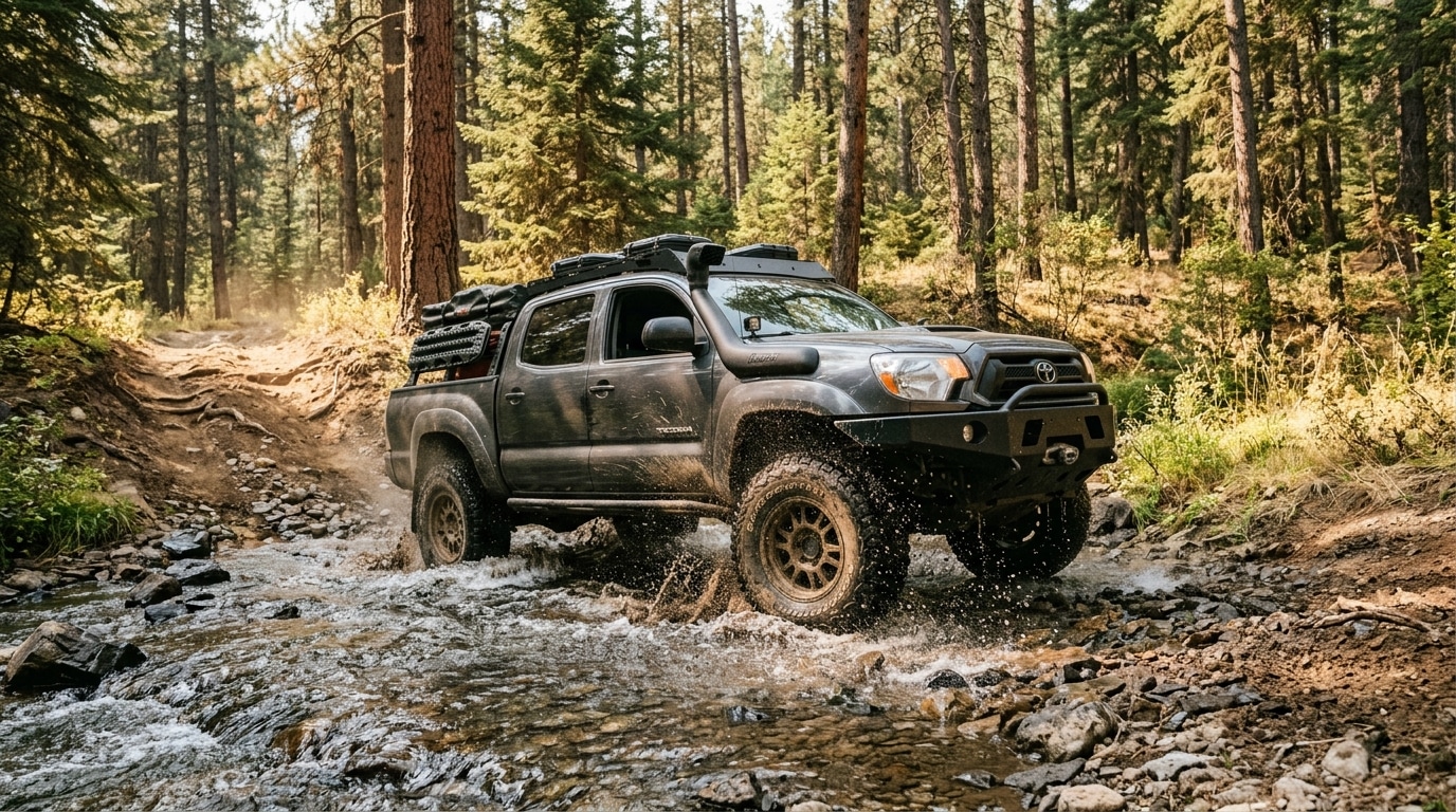
Little Naches is the OHV heart of this list, off Highway 410 near Naches. Free riverside pullouts line Bumping River Road, while Forest Road 1900 and its spurs open a genuine 4×4 and OHV trail network with rock and water crossings. A stock crossover camps fine along the river, yet the OHV spurs demand a built rig. Notably, the trail system runs roughly mid-June through mid-October, since snow and spring mud close it otherwise. Weekends pack out fast, so arrive early.
West Cascades and the Olympic Rainforest
Moss, mud, and old-growth define the wet west side, where dry windows shrink and the roads soften.
Mountain Loop Highway
The Mountain Loop Highway near Granite Falls runs paved, then turns to a graded gravel section closing in winter. Free riverside pullouts dot the gravel stretch, reachable by most SUVs when dry. After rain, however, the spur roads grease up into classic west-side mud, so high clearance helps. A Northwest Forest Pass covers only the developed trailheads like Big Four. Old-growth, waterfalls, and the South Fork Stillaguamish frame the camp.
Baker Lake Road
Baker Lake Road delivers the easiest entry on this list, paved and well-graded under Mount Baker and Mount Shuksan. Free dispersed pullouts sit right off Forest Road 11, friendly to stock SUVs and even small trailers at the easy spots. Side roads roughen and reward clearance, while the main road stays mellow. Sitting at low elevation, it opens earlier than the high Cascades, roughly May through October. Expect wet, mossy ground outside summer.
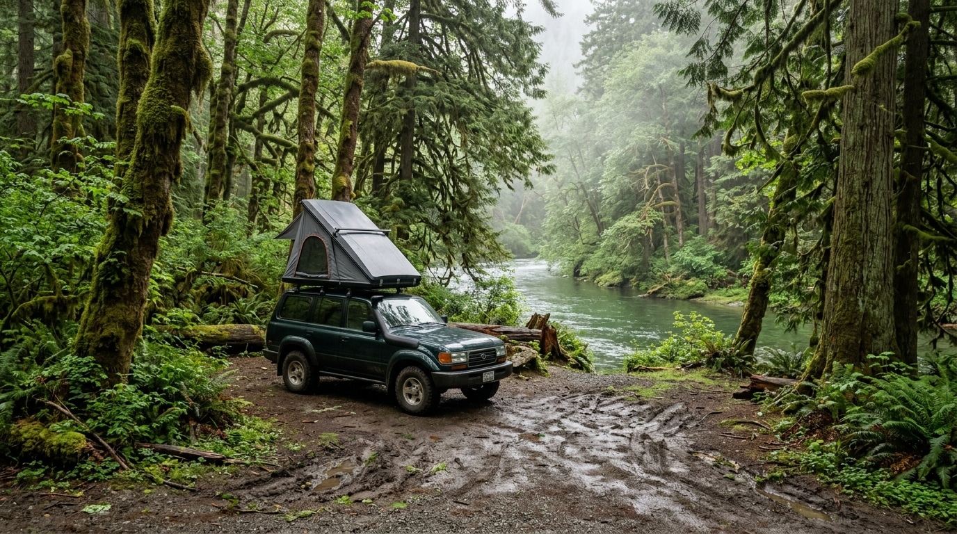
Dispersed Camping in Olympic National Forest
For rainforest solitude, dispersed camping in Olympic National Forest centers on the Hamma Hamma River Road and the Wynoochee area. Graded gravel reaches the riverside pullouts, though the spurs run muddy, mossy, and washout-prone in the near-constant rain. Olympic sets a stricter siting rule: camp out of sight of roads and trails, and 200 feet from water. Check current alerts first, since the Lake Cushman corridor stays closed after the 2025 fire. July through September brings the only reliably dry window. Few places make dispersed camping in Olympic National Forest feel as remote as a moss-draped river bench.
Volcano Country: Gifford Pinchot
Southern Washington stacks two volcanoes and a string of waterfalls into one forest, closer to Portland than Seattle.
Lewis River and Forest Road 90
The Lewis River corridor pairs free dispersed pullouts with a chain of waterfalls along Forest Road 90. Its main road runs paved, yet the Forest Service warns the stretch past Lower Falls turns rough enough to want high clearance in spring. Rougher spurs branch off for built rigs. Because snow melts off late, the full corridor opens early summer through fall. Old-growth and the Lower, Middle, and Upper Falls anchor the trip.
Mount St. Helens Forest Roads
On the volcano’s south side, Forest Roads 83 and 81 hold dozens of free pullouts with existing fire rings and direct Mount St. Helens views. Most mains run paved or graded, while spur pullouts vary and pick up volcanic ash and washouts. One caution: the National Volcanic Monument has permit and fee zones, so camp on the surrounding forest roads, not inside restricted areas. Ape Cave lava tubes and Lava Canyon sit minutes away. Summer and fall run best.
Takhlakh and Council Lake
Near Mount Adams, the Takhlakh area frames one of the state’s great volcano reflections. Skip the paid Takhlakh Lake Campground and camp free along the surrounding high roads near Council Lake instead. These gravel forest roads run rough, so high clearance helps on the spurs. At 4,400 feet, the window is short, roughly July through October, since snow gates the area otherwise. Huckleberries ripen across the slopes in late summer.
The Dry East: North Cascades, Methow, and Colville
East of the crest, the forest dries out, the season stretches, and the larch turns gold. This is some of the strongest overland country in the state.
Harts Pass Road
Harts Pass Road is the most serious off-road access in Washington, climbing past Mazama toward the highest drivable point in the state near 6,200 feet. The narrow gravel shelf road bans trailers from June through December and offers no guardrails over steep exposure. As a result, high clearance and steady nerves are required. Snow keeps it closed until about July, and it closes again early. The payoff is alpine tundra, Pacific Crest Trail access, and some of the state’s finest fall color.
Methow Valley and Highway 20
Around Twisp and Winthrop, free dispersed spreads across a vast network of forest roads off Highway 20. Graded gravel suits SUVs, while rougher spurs like Twisp River Road reward high-clearance 4×4. Because the east side dries firm, the roads hold up better than the wet west, though dust and washboard are the trade. Highway 20 itself closes over the passes in winter. Each October the valley glows gold, one of the Northwest’s great fall-color drives.
Colville National Forest
In the state’s quiet northeast corner, Colville National Forest offers broadly free dispersed under a 14-day limit, about two hours from Spokane. Narrow gravel roads reach most sites, and high clearance helps on the rougher spurs. The drier, lower terrain holds one of the longest dependable seasons in the state, roughly May through October. Each district publishes its own map, so confirm where dispersed is allowed. Lakes, quiet forest, and moose reward the remoteness.
Fishtrap and Juniper Dunes (BLM)
For an even longer, drier season, the BLM lowlands near Spokane stay open most of the year. Fishtrap, about 40 minutes southwest of the city, offers easy gravel pullouts friendly to a stock SUV or van. Juniper Dunes, near Pasco, flips the script with soft sand, where anything short of an aired-down 4×4 or a dedicated OHV bogs down. Both run free with no pass and a 14-day limit. Because summer bakes the open country, spring and fall ride best.
From the 4wdTalk Garage
Washington punishes two things: bad timing and bad traction. West of the crest, the enemy is mud. Air down for grip, and also carry traction boards. Turn back when a spur turns to soup, rather than carving ruts others inherit. East of the crest, the enemy is the calendar. The best roads melt out for only a few months, and fire restrictions clamp down by midsummer. Two moves cover most of it: check the forest alerts page within 48 hours of leaving, and pack real recovery gear. Before your first trip, also review our primitive camping tips to cover the basics of camp setup, water, and waste. See our list of 4×4 recovery gear to pack before a wet-season run.
Which Washington Spot Fits Your Rig and Season?
Pick by clearance first. A stock SUV does well at Baker Lake Road, the North Fork Teanaway river sites, Mount St. Helens, and the Methow gravel roads, where graded surfaces reach good camps. These rank among the best dispersed camping in Washington for any rig.
Step up to a high-clearance 4×4 for the rocky spurs at French Cabin Creek and the muddy Olympic and Mountain Loop spur roads. Save Little Naches and Harts Pass for a built, capable rig. OHV trails and a cliff-edge shelf road end the day for anything less.
Pick by season next. Dispersed camping in Washington runs July through October in the high Cascades. By contrast, the dry east side and the BLM lowlands stretch from May into late fall. Avoid the west side in the wet months, and skip any snow-gated road until the forest confirms it is open.
Final Verdict
Washington gives off-roaders a rare mix of rainforest, volcano, and high-desert free camping, all on public land. For a first trip, Baker Lake Road or the Methow Valley delivers easy access, big views, and a forgiving season. Planning a longer road trip? Best Free Dispersed Camping in Colorado and Best Free Dispersed Camping in Southern California pair well with a Washington loop.
The terrain demands respect, though. Snow gates the passes, atmospheric rivers wash out roads, and fire restrictions clamp down fast. Check the forest alerts page before every trip. Watch the pass rules too, since the Discover Pass and the Northwest Forest Pass cover different land.
Match the spot to your build and your calendar, and you skip two classic errors. Avoid sinking a low car in west-side mud, or driving four hours to a snow-gated road. The decision section above sorts every site by clearance and season.
Start at a graded river road, build your kit and your rain skills, then earn Harts Pass and the Little Naches trails. For deeper solitude beyond the well-known pullouts, our guide on how to find secluded camping spots walks you through the full process. Free dispersed camping in Washington runs from spring lowland forest to October larch, open somewhere across the state nearly half the year.
More Free Dispersed Camping Guides by State
- Best Free Dispersed Camping in Southern California
- Best Free Dispersed Camping in Colorado
- Best Free Dispersed Camping in Utah
- Best Free Dispersed Camping in Oregon
Frequently Asked Questions
Is dispersed camping free in Washington?
Yes. Dispersed camping in Washington is free to camp on national forest, BLM, and DNR land. The Northwest Forest Pass covers parking at certain fee trailheads. A Discover Pass covers parking on DNR land. Neither charges for the camping itself. Always confirm the rule for your specific road before you go.
Do you need a Discover Pass or Northwest Forest Pass to camp?
It depends on the land. National forest dispersed camping needs no pass to camp, though the Northwest Forest Pass covers parking at developed fee trailheads. DNR land requires a Discover Pass to park, which runs $45 a year as of October 2025. BLM dispersed needs neither.
What is the stay limit for dispersed camping in Washington?
National forest and BLM land allow 14 days at one site, with annual caps on some forests. DNR land uses a shorter 10-day limit instead. Rangers enforce these in popular areas, so track your nights and move on when your time is up.
When do Washington forest roads open for dispersed camping?
Low-elevation roads on the dry east side and the BLM lowlands often open by May. High Cascade roads stay snow-gated until late June or July, and passes like Harts Pass open last. Always check the forest alerts page, because storms and washouts close roads with little notice.
Do you need a 4×4 for dispersed camping in Washington?
It depends on the spot. Graded roads like Baker Lake Road and the Methow gravel welcome a stock SUV when dry. The harder routes, including Little Naches, Harts Pass, and the muddy west-side spurs, demand a high-clearance 4×4. Match the rig to the road, and check conditions first.
Where is the best dispersed camping near Seattle?
The closest free dispersed sits in the central and west Cascades. Within about two hours, the Mountain Loop Highway and the North Fork Teanaway lead the list, while Baker Lake Road runs a bit farther at two and a half to three hours. For drier weather and a longer season, the Methow Valley and Colville sit farther east but reward the drive.