


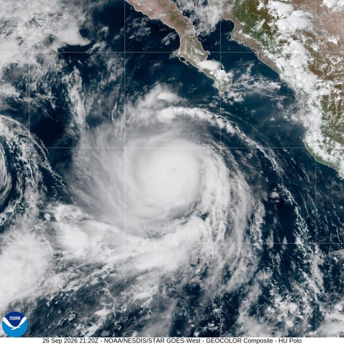
Quick Facts:
- Storm: Hurricane Polo, Category 4, 145 mph sustained winds (NHC Advisory 25, 2 p.m. MST Saturday, September 26).
- Position: About 335 miles south-southwest of Cabo San Lucas, moving northwest at 10 mph.
- Hurricane Watch: Punta Eugenia to Santa Fe, on the Pacific coast of Baja California Sur.
- Timing: Tropical storm conditions possible in the south Sunday night into early Monday; hurricane conditions possible by Monday afternoon.
- Rain: 4 to 8 inches, with up to 10 inches in spots, bringing flash floods and mudslides.
- Track: Across the peninsula Monday night, then toward northwestern mainland Mexico by early Tuesday.
- Updates: This box reflects NHC Advisory 25. The NHC issues a full advisory every six hours, so check nhc.noaa.gov before you act.
8 min read
In This Article
Where Hurricane Polo Stands Now
Camped on a beach or in a wash in Baja California Sur? Break camp today if possible, by Sunday morning at the latest, and drive only in daylight. Hurricane Polo, a Category 4 with 145 mph winds, sits about 335 miles south-southwest of Cabo San Lucas. Those figures come from the National Hurricane Center’s 2 p.m. MST advisory on Saturday, September 26.
The storm is moving northwest at 10 mph. Next, forecasters expect a turn north on Sunday and a turn northeast on Monday. On this track, the center approaches the Pacific coast of Baja California Sur on Monday. It then crosses the peninsula Monday night and approaches northwestern mainland Mexico by early Tuesday.
Polo briefly regained Category 5 strength before the NHC downgraded it Saturday, and forecasters expect steady weakening from here. Even so, the NHC says Polo should still be a strong hurricane when it reaches Baja. A Hurricane Watch covers the Pacific coast from Punta Eugenia to Santa Fe. In addition, the NHC expects watches for the Gulf of California side of the peninsula and possibly for northwestern mainland Mexico.
When Hurricane Polo Reaches Baja
The table below turns the NHC forecast points into plain times. All times are MST, local time in Baja California Sur and the same as California this time of year. Treat them as a guide, not a schedule. The NHC calls its track confidence “not particularly high.” Its models disagree on forward speed, and a few even stall Polo offshore.
| Forecast time (MST) | Forecast center | Winds | What it means on the ground |
|---|---|---|---|
| Sunday 11 a.m. | Offshore, southwest of the peninsula | 120 mph | Last full daylight to break camp and drive |
| Sunday 11 p.m. | Offshore, closing on the Pacific coast | 110 mph | Heavy rain and tropical storm winds possible in the southern watch area |
| Monday 11 a.m. | About 60 miles west of Cabo San Lázaro, off the Pacific coast | 100 mph | Tropical storm winds spread north; hurricane conditions possible by afternoon |
| Monday 11 p.m. | Inland, mid-peninsula between Loreto and Mulegé | 80 mph | Stay inside and off the roads |
| Tuesday 11 a.m. | Inland over northwestern mainland Mexico | 60 mph | Rain continues over Baja California Sur; wait for roads to reopen |
Rain and wind both arrive Sunday night. The NHC expects heavy rain over Baja California Sur from Sunday night into Tuesday. Totals run 4 to 8 inches, with local amounts near 10 inches. Tropical storm winds are possible in the southern part of the watch area Sunday night, then spread north on Monday.
Reuters, citing AccuWeather, reported the landfall zone sits away from big towns, near Las Barrancas on the Pacific side. From there, the forecast carries the center inland, passing between Loreto and Mulegé Monday night.
Leave, Stay, or Move to Town
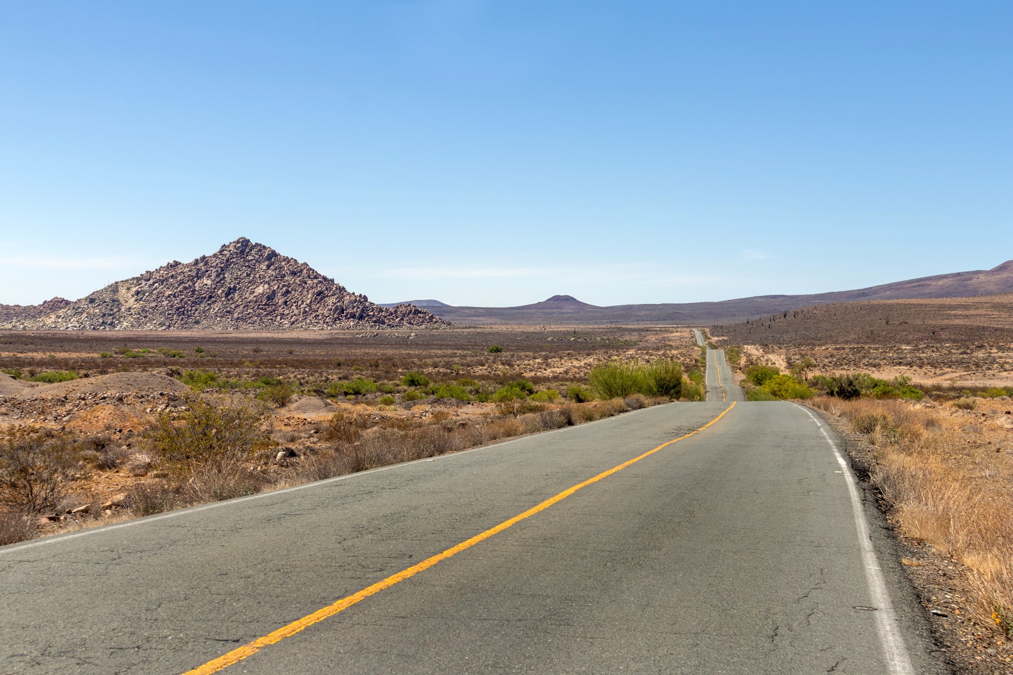
Your best move depends on where you are parked tonight. First, follow any order from Baja California Sur’s Protección Civil, because local officials know which shelters and roads are open.
Safety note: Beach camps carry the highest risk in this storm. Leave any beach or estuary camp today if possible, and by Sunday morning at the latest, in daylight. The NHC warns of storm surge with large, destructive waves where winds blow onshore. Separately, the U.S. Embassy told travelers to stay out of the water and off the beaches.
Region by Region: Drive North or Shelter in Town
At Guerrero Negro or farther north, drive north on Sunday, in daylight, to stay ahead of the rain. Check the latest advisory before you go, since the track is uncertain.
Mid-peninsula, from Ciudad Constitución through Loreto, Mulegé and the Bahía Concepción beaches, you sit on the forecast path. The table puts the center between Loreto and Mulegé late Monday. Here, a solid room in town, away from arroyos and the shore, is the safer plan. A run north means hours on a remote highway through the same zone. If the storm speeds up, you meet it on the road.
In La Paz or Los Cabos, south of the track, Reuters reported the projections keep the center north of Los Cabos. Still, the U.S. Embassy expects heavy rain across all of Baja California Sur from Sunday through Tuesday. Stay in town, off the beach and away from arroyo crossings.
For me, the smart move this weekend is the boring one. Unless you are already north of the storm, pick a solid building in a real town. Then stay put until the roads reopen. A rooftop tent, a truck camper or a van is no place to ride out 80 to 100 mph winds.
Staying in Touch When Cell Service Drops
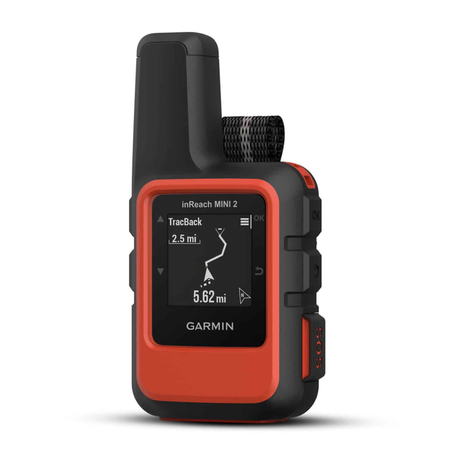
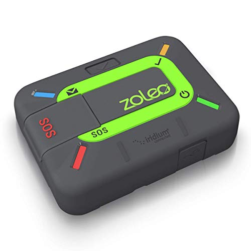
Cell service and power often fail in a storm like this. For example, the Gringo Gazette reported CFE, the federal utility, might cut power in high-risk Los Cabos zones. A satellite messenger keeps working after the towers fail. Many two-way units, including Garmin inReach and ZOLEO models, also pull a basic weather forecast by satellite. This matters once the NHC page stops loading.
Before the rain starts, send your location and plan to someone at home. Then set a check-in time. Save 911, Mexico’s emergency number, plus 078 for the Ángeles Verdes roadside help line (8 a.m. to 8 p.m.). The U.S. Embassy also runs a WhatsApp alert channel for Americans in Mexico. Meanwhile, the State Department runs the Smart Traveler Enrollment Program (STEP) for trip alerts. Our guide to staying connected without cell service covers the backup options in more depth.
My take: a satellite messenger belongs in every Baja rig, storm or not. Our satellite communicator vs radio guide compares messengers with GMRS and ham radio. For your next trip south, the communicators below cover two-way texting, SOS and forecast pulls. Activate the plan and send a test message before you leave home.
Satellite Messengers With SOS and Forecasts


Arroyos, Vados and Flooded Roads
Once the rain starts, water is the bigger danger on the road. Mexico Highway 1 dips through dozens of vados, the low concrete crossings where arroyos cut across the pavement. Those dips turn into moving rivers within minutes to hours of a hard rain, and the water often looks shallow from the driver’s seat. Los Cabos crews watch low crossings under a “Cruce Seguro” (Safe Crossing) program, the Gringo Gazette reports.
Safety note: Never drive into moving water at a vado. The National Weather Service says 12 inches of rushing water carries away most cars, and 2 feet is enough to carry away SUVs and trucks.
A lift and a snorkel change none of this math, because moving water floats a truck long before it floods the intake. Instead, park on high ground well back from the arroyo and wait for the flow to stop. Also, never camp in a dry wash, since rain on the mountains upstream sends water down a clear-sky arroyo.
After the storm, expect washouts, rockfall and mud on the grades, the same slopes the NHC flags for mudslides. Once Protección Civil reopens a road, drive it in daylight only. Treat every dip as washed out until you see the far side.
What This Means for You
If a Baja Road Trip Starts This Week
Push the start date back. The U.S. Embassy expects flooding, mudslides and road closures across Baja California Sur from Sunday through Tuesday. On the mainland side, its alert says Sonora’s Highway 15, underpasses and bridges might be affected. Wait until Protección Civil reports Mexico Highway 1 open end to end before you cross the border.
If You Plan Baja Overlanding Later This Fall
Storms like Polo reshape dirt routes. As a result, the washes and beach roads in last spring’s Baja overlanding guides might not match what you find in October. The eastern Pacific hurricane season also runs through November 30, so check the NHC before any fall trip. In addition, look at whether your plan covers a rescue; our look at search and rescue insurance for overlanders explains where health plans stop.
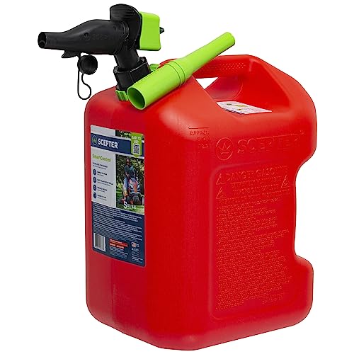
Carry extra water and fuel, and pack recovery gear for mud as well as sand. Before a fall trip south, the gear below covers those three basics: water, fuel and mud recovery.
Water, Fuel and Mud Recovery for a Baja Trip



If You Live in Southern California or the Southwest
I live in Orange County, so this part hits close to home. Southern California beach hazard statements for elevated surf and high tides run from Friday through Wednesday afternoon. The biggest waves and tides arrive Sunday, peak Monday and last through Tuesday, especially at south-facing beaches.
Meanwhile, the NHC says moisture from Polo and Hurricane Odalys moves into the southwestern U.S. late this weekend and early next week. It might indirectly add to a heavy rain and flash flood threat there. The National Weather Service in San Diego puts the best rain chances over the mountains and deserts of San Diego and Riverside counties. Check the forecast before you point your rig at a desert wash this week.
Final Thoughts
Hurricane Polo is weakening, but it still reaches Baja California Sur as a strong hurricane with enough rain to close roads for days. The Pacific surf towns and the mid-peninsula stretch between Ciudad Constitución and Mulegé carry the most risk. Los Cabos and La Paz sit south of the center’s path, yet they still face heavy rain, and Los Cabos faces rough surf.
If you are in Baja right now, the decision is simpler than it feels. Fill your tank and water jugs, then move off the beach. Get into a solid building in town before the rain starts, and stay off the roads until they reopen. At Guerrero Negro or farther north, keep heading north on Sunday, in daylight.
Most Baja overlanding trips end with a sunburn and a fish taco, and yours still has every chance to. Here is hoping every rig is off the sand by Sunday, and every Baja town comes through safe. After the storm, give the peninsula time to drain and let crews reopen the highway. Then go, once the roads reopen, with a greener desert waiting for you.
Hurricane Polo FAQ
Is Mexico Highway 1 closed because of Hurricane Polo?
As of Saturday afternoon, the U.S. Embassy alert listed no full closure. However, the Embassy expects flooding, mudslides and road closures across Baja California Sur from Sunday through Tuesday. Check Protección Civil before you drive.
Where will Hurricane Polo make landfall?
The NHC forecast brings the center to the Pacific coast of Baja California Sur on Monday and across the peninsula Monday night. AccuWeather points to a sparsely populated stretch near Las Barrancas. Track confidence remains low, so check each new advisory.
Will Hurricane Polo hit Cabo San Lucas?
Current projections keep the center north of Los Cabos, according to Reuters. Even so, the Embassy expects heavy rain across all of Baja California Sur. The port authority also closed Cabo San Lucas and San José del Cabo to small boats.
Should I cancel a Baja road trip planned for next week?
Postpone it rather than cancel it. Rain continues through Tuesday, and washed-out vados and mudslides take time to clear. Wait for Protección Civil to report the highway open.
Will Hurricane Polo affect Southern California?
Yes, mostly through surf and moisture. Beach hazard statements run through Wednesday afternoon, with large surf and high tides Sunday through Tuesday. The NHC says moisture from Polo and Odalys might indirectly add to the Southwest flash flood threat early next week.