


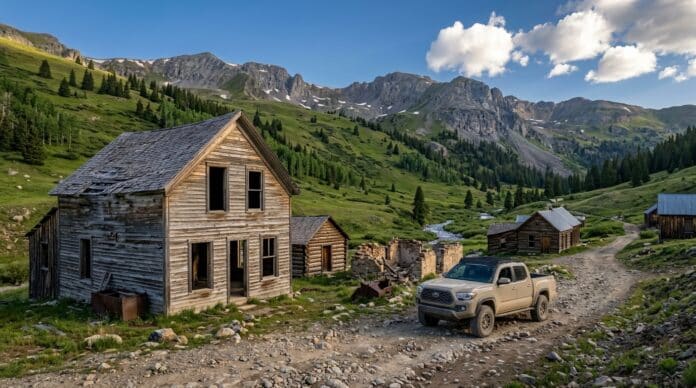
Quick Facts:
- Topic: Colorado ghost towns you reach by dirt road or 4×4 trail
- Towns covered: 10, ranked from easiest to hardest drive
- Easiest stop: St. Elmo, a passenger-car drive at 10,000 feet
- Hardest stop: Holy Cross City, where the Forest Service warns stock vehicles to stay off the road
- Highest pass on the list: Imogene Pass at 13,114 feet, above Tomboy
- Main season: Late June through September for most high passes
- OHV permit: $26.25 for plated vehicles on designated OHV trails and open areas
- Best for: High-clearance 4WD owners who like history with their dirt
12 min read
In This Guide
- Why Colorado Ghost Towns Suit a 4×4 Trip
- Key Facts at a Glance
- 10 Colorado Ghost Towns Ranked by 4×4 Difficulty
- What Vehicle You Need
- When Colorado’s High Roads Open
- Navigation, Gear, and Mine Safety
- OHV Permits, Private Land, and Artifacts
- Camping Near the Ghost Towns
- Colorado Ghost Towns vs. Bodie, California
- Final Verdict
- FAQ
Why Colorado Ghost Towns Suit a 4×4 Trip
Colorado ghost towns sit at the end of rough mining roads in the Colorado high country. Miners chased silver and gold into high basins in the 1870s and 1880s, and their wagon roads still lead to cabins, mills, and jails. For a trail driver, a ghost town turns a random turnaround point into a real destination.
This guide ranks 10 ghost towns in Colorado by how hard the drive is. First come stops you reach in a family SUV, such as St. Elmo. Next come high-clearance drives on Colorado’s Alpine Loop and above Telluride. Finally, the list ends with Holy Cross City, where the Forest Service calls the road “extreme.”
Each entry covers the access road, the vehicle you need, what still stands, and who owns the ground. Ownership matters because several famous sites, including Tomboy, Alta, and the Crystal Mill, sit on private land. In those cases, you view the buildings from the road.
For a first trip, start with St. Elmo and Animas Forks. Both suit a stock vehicle in summer, and St. Elmo sits near developed campgrounds such as Iron City.
Key Facts at a Glance
Use this table as a quick reference before you pick a route. The numbers come from the BLM, the Forest Service, Colorado Parks and Wildlife, and local visitor bureaus.
| Fact | Details |
|---|---|
| Silverton to Lake City byway length | 63 miles per the BLM byway page (its brochure rounds to 65) |
| Byway visitors | More than 100,000 people per year (BLM) |
| Engineer and Cinnamon passes | 12,800 feet and 12,600 feet |
| Typical pass opening | Late June, closing with the first big fall storms |
| Cell service on the byway | Does not work in most areas (BLM) |
| OHV permit for plated vehicles | $26.25, valid April 1 to March 31, designated trails and open areas only |
| Unsafe mine features statewide | About 23,000 left unsafeguarded by historic mining (Colorado DRMS estimate) |
10 Colorado Ghost Towns Ranked by 4×4 Difficulty
We ranked the towns by the vehicle each land agency or visitor bureau calls for, from passenger car to modified 4×4. Within the 4WD group, shelf roads, loose rock, and agency warnings pushed a town lower on the list.
| Rank | Town | Access Route | Vehicle Needed | Land Status |
|---|---|---|---|---|
| 1 | St. Elmo | County Road 162 from US 285 | Passenger car | Private homes plus nonprofit-owned public buildings |
| 2 | Capitol City | County Road 20 from Lake City | Passenger car, driven slowly | Private homes and parcels nearby |
| 3 | Winfield | County Road 390 off US 24 | Rough dirt road; clearance helps | National Forest interpretive site |
| 4 | Animas Forks | County Road 2 from Silverton | 2WD in summer; 4WD beyond town | BLM |
| 5 | Alta | Alta Lakes Road off CO 145 | High clearance recommended | Private townsite |
| 6 | Tincup | Tincup Pass Road 267 from St. Elmo | High-clearance 4WD | Private cabins inside National Forest |
| 7 | Tomboy | Tomboy/Imogene Road 869 from Telluride | High-clearance 4WD strongly recommended | Private townsite |
| 8 | Carson | Wager Gulch spur off the loop | High-clearance 4WD required | Private, view from a distance |
| 9 | Crystal | County Road 3 (Forest Road 314) from Marble | High-clearance 4WD required | Private mill, fee for close access |
| 10 | Holy Cross City | Homestake Road 703, then Forest Road 759 | Modified 4×4 only | Forest Service, some private |
Before you pick a town, plan for dead phones. According to the BLM, “cell phones and wireless devices do not work in most areas of the Alpine Loop.” Because of this gap, carry a satellite messenger on any high-country trip. These three models send texts and SOS alerts with no cell signal.
| Top Pick | Best for Phone Pairing | Best Budget | |
|---|---|---|---|
| Product | TOP PICK Garmin inReach Mini 3 Plus Garmin inReach Mini 3 Plus |  Garmin inReach Messenger Garmin inReach Messenger |  ZOLEO ZOLEO |
| Rating | ★★★★★ 4.7 132 ratings | ★★★★☆ 4.4 439 ratings | ★★★★☆ 4.4 3,200 ratings |
| Network | Iridium | Iridium | Iridium |
| SOS | 24/7 via Garmin Response | 24/7 via Garmin Response | 24/7 via GEOS |
| Battery Life | 350 hrs | 672 hrs | 200 hrs |
| Price | $445.75 as of Sep 24, 5:27 pm | $269.00 as of Sep 24, 12:22 pm | $149.00 as of Sep 24, 9:48 am |
| Check Price → | Check Price → | Check Price → |
1. St. Elmo: The Easy Gateway
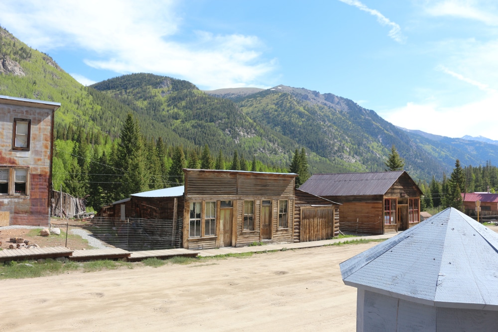
St. Elmo sits at 10,000 feet in Chalk Creek Canyon, about 15 miles up County Road 162 from US 285 near Nathrop. A passenger car makes the drive in summer. Miners founded the town in 1880 as Forest City, and as many as 2,000 people lived here in 1881. Today, roughly 40 early buildings still stand, so it ranks among the best-preserved towns in the state. Also, St. Elmo is the gateway to two high passes: Tincup Pass, which starts in town, and Hancock Pass, which starts at the Hancock townsite about 5.5 miles up Forest Road 295.
2. Capitol City: A Would-Be Capital
George S. Lee founded Capitol City in 1877 and hoped it would become the state capital. The camp lies nine miles up the Henson Creek road from Lake City, and it held 800 people at its peak. However, only the old post office and Lee’s smelter stack remain, with private homes around them. Most passenger cars make the trip, although the road past town climbs toward Engineer Pass and needs 4WD.
3. Winfield: Old Schoolhouse in Clear Creek Canyon
County Road 390, the Clear Creek road, leaves US 24 between Buena Vista and Leadville and reaches Winfield after 11 miles. Settlers laid out the townsite in 1881, and it peaked at about 1,500 people in 1890. Then the 1893 silver crash temporarily halted mining, and the last ore left the canyon in 1918. Four original log buildings survive, including the old schoolhouse. Visitors describe washboard and rocks on the road, so bring a vehicle with decent clearance.
4. Animas Forks: The San Juan Anchor
Animas Forks sits at 11,200 feet, 12.3 miles above Silverton on County Road 2. By 1883, about 450 people lived here, according to the BLM. In 1884, a 23-day blizzard buried the town under 25 feet of snow. Nine buildings still stand, including the two-story Duncan House and the jail. The BLM owns the site, and it bans camping or fires within 800 feet. In summer, 2WD reaches town, while the roads beyond need high-clearance 4WD.
For a closer look, this walkthrough from Big Altitude tours the Duncan House, the jail, and the rest of the town.
5. Alta: First Mine With AC Power
According to Colorado Preservation, Inc., Alta’s Gold King Mine was the first mine in the world to receive AC power. The mine sits at 11,000 feet, and the site keeps many original structures, including a stabilized boardinghouse. To get there, take Alta Lakes Road from CO 145, six miles south of Telluride, and drive four miles up. Visit Telluride recommends a high-clearance vehicle. Private owners hold the townsite, so admire it from the road. Still, the Forest Service lakes above town offer designated campsites.
6. Tincup: A Pass Worth the Climb
Tincup Pass Road 267 leaves St. Elmo and tops out at 12,154 feet after 6.5 miles. After the summit, it drops to Tincup Town Hall at mile 13.4. Plan on high-clearance 4WD for this rough jeep road. Tincup reportedly held about 2,000 people around 1900. Notably, Gunnison County’s website says Tincup is not a true ghost town, since owners restored many cabins. Even so, the pass road makes Tincup a rewarding ghost town drive.
7. Tomboy: Below Imogene Pass
Forest Road 869 climbs about 4.5 miles from Telluride into Savage Basin, where Tomboy’s ruins sit beside the road. Visit Telluride says the town once housed 1,000 people, and the Tomboy Mine closed in 1927. Several buildings and mining relics remain. The Forest Service lists July as the season and strongly recommends high-clearance 4WD. San Miguel County also bans unlicensed OHVs on the first 2.5 miles from Telluride. Past town, the road keeps climbing to Imogene Pass at 13,114 feet. Because the townsite is private, stay on the road.
In this 2025 run, Expedition Builds climbs from Telluride past the Tomboy ruins and on to Imogene Pass.
8. Carson: A Spur Off the Loop
Carson sits up Wager Gulch, a rough spur off the loop. Lake City tourism calls the town particularly well preserved. A second site, Old Carson, lies farther up near the Continental Divide. The first half of the road is the rougher half, and the road requires high-clearance 4WD. Expect to share it with OHVs, motorcycles, and hikers. Both sites sit on private land, so you view them from a distance. BLM’s Mill Creek Campground on County Road 30 makes a good base.
9. Crystal: One of Colorado’s Most Photographed Mills
Nearly 600 people lived in the Crystal camp by the end of 1883. Then, in 1892, builders put up the mill as an air-compressor powerhouse for nearby silver mines, and it ran until 1917. History Colorado calls the Crystal Mill reportedly one of the most photographed sites in the state. Access comes via County Road 3 (Forest Road 314) from Marble, which the Colorado Encyclopedia calls extremely rough. The Forest Conservancy, a Forest Service volunteer partner, rates the Lead King Basin loop difficult. It also warns against the Lead King Basin road when wet. In addition, it describes the stretch from Lead King Basin to Crystal as narrow and extremely rocky, with a steep drop-off. Treasure Mountain Ranch has owned the mill since 1954, and close access carries a fee.
Next, watch Wandering Wakims drive from Marble to the mill and the old Crystal townsite.
10. Holy Cross City: For Built Rigs Only
Holy Cross City sits at 11,335 feet on Forest Road 759, reached from Homestake Road 703. The Forest Service calls it an extreme road and warns, “Stock vehicles should not attempt this one.” Miners founded the gold camp in 1880, and it emptied by 1884. Today, mill remnants and a few buildings remain on Forest Service land, with some private claims. Before you go, the Forest Service suggests checking a 4WD guidebook for recommended vehicle specs.
What Vehicle You Need
Half the towns on this list need a high-clearance 4WD with low range. Lake City tourism says the full loop needs high-clearance 4WD, and stock SUVs with low-range gearing meet the standard. However, drivers without high-clearance 4WD should stay off the pass roads. The west side of Engineer Pass, between Animas Forks and the summit, is the most technical stretch. For this reason, Lake City tourism suggests driving the loop clockwise from Lake City, so you climb those switchbacks instead of descending them.
Tires matter as much as lift. Sharp shale and talus chew through thin passenger tires, so a strong all-terrain tire is a sensible baseline. Airing down also smooths washboard and improves grip on loose climbs. Before you return to pavement, air back up with a portable compressor.
Crystal and Holy Cross City sit in a separate class. The road to Crystal includes a narrow, extremely rocky stretch with a steep drop-off, and the Forest Service says stock vehicles should not attempt the Holy Cross City road. Therefore, run those two with a second vehicle, recovery points, and a driver who knows how to follow a spotter. If you drive a stock rig, pick your towns from ranks 1 through 5.
When Colorado’s High Roads Open
Engineer, Cinnamon, and other high passes usually open in late June and close with the first big fall storms. The Forest Service lists July as the season for the Tomboy and Imogene road.
Snow is the main variable. In 2019, avalanches buried the road near Animas Forks under more than 100 feet of snow and kept it closed until July, according to Lake City tourism. Therefore, check BLM and Forest Service pages the week before you leave. Lower towns such as St. Elmo usually open earlier, since their roads sit below the big passes.
July and August bring afternoon storms. To avoid them, start high-pass drives early and plan to leave the summits by early afternoon. September brings cooler temperatures, although early snow sometimes closes roads without warning.
Navigation, Gear, and Mine Safety
Download offline maps before you leave Silverton, Lake City, or Buena Vista. Many forest roads carry both a county number and a Forest Service number, so a map app with both saves wrong turns. Our list of the best off-road GPS apps compares the top offline options. In addition, carry a paper backup, such as National Geographic Trails Illustrated map 141 for Telluride, Silverton, Ouray, and Lake City.
Bring warm layers too, since summits above 12,000 feet run much colder than town. For messaging, compare a satellite communicator vs. GMRS radio before you buy.
Safety note: Never enter a mine opening or climb on mill structures. Colorado DRMS estimates historic mining left about 23,000 hazardous features unsafeguarded, and its records show abandoned mines have claimed 18 lives since 1955. Bad air, rotten timbers, and hidden shafts give no warning.
Old buildings also carry risk. Floors, roofs, and stairs in these towns are more than a century old. Instead of walking inside, photograph through doorways and windows.
Pack for flat tires and slow repairs. A tire plug kit and a portable air compressor handle most trail punctures, and both fit behind a rear seat. Paired with the Trails Illustrated map, these three items cover navigation and tire trouble on most routes in this guide.
Gear for Colorado ghost town trips




MORRFlate TenSix PSI Pro 12 Volt Air Compressor Heavy Duty
OHV Permits, Private Land, and Artifacts
Colorado Parks and Wildlife requires a $26.25 OHV permit for plated vehicles on designated OHV trails and open areas. The permit runs April 1 to March 31, and the sticker goes to the right of the front license plate. According to Stay The Trail, plated vehicles on county roads or three-digit Forest Service roads do not need the permit. However, some three-digit routes count as trails. Before you go, read a Motor Vehicle Use Map for each route. If any leg of your trip uses a designated trail, buy the permit before you leave.
Private land is a common source of trouble. Tomboy, Alta, Carson, and the Crystal Mill sit on private land, and private parcels surround Capitol City. As a result, you view those sites from the road unless the owner allows entry or sells access. Respect closed gates and “No Trespassing” signs every time.
Taking artifacts from public land breaks federal law. For items at least 100 years old, the Archaeological Resources Protection Act carries fines up to $10,000 and one year in prison for a first offense. The cap rises to $20,000 and two years when the damage tops $500. Forest Service and BLM rules go further and ban removing any historic item, regardless of age. Leave nails, bottles, and ore samples where you find them. The BLM’s byway brochure lists the site rules in full.
Camping Near the Ghost Towns
Developed campgrounds sit near several towns. For example, Iron City Campground near St. Elmo has 15 sites at $22 per night. Mirror Lake Campground, three miles east of Tincup, has 10 sites at $14 per night. Bogan Flats Campground near Marble has 36 sites on Recreation.gov, including one group site, for Crystal trips.
Dispersed camping works well for Winfield, where a Forest Service area sits a five-minute walk from the townsite. Alta Lakes also allows dispersed camping in designated spots only. Near Animas Forks, remember the 800-foot buffer around the historic site. For more options, see our guide to free 4×4 campsites in Colorado and our list of spots for camping near Silverton.
Colorado Ghost Towns vs. Bodie, California
If you have toured Bodie in California, Colorado feels different. Bodie makes a useful benchmark for western ghost towns. California State Parks took it over in 1962 and keeps it in “arrested decay,” which means crews stabilize buildings without restoring them. Bodie sits at 8,375 feet, and the last three miles of road are unpaved. Because the state runs the whole site, one ticket gets you a whole town under one set of rules.
Colorado ghost towns work differently. The BLM, the Forest Service, nonprofits, and private owners each manage different sites. Consequently, you trade one easy visit for a string of smaller stops linked by high passes. The drive itself becomes half the experience, especially in the San Juans.
From experience: Years ago, I visited Bodie during a photography workshop. Bodie puts an entire preserved town in front of you at once. Colorado spreads its history across high basins and mixed ownership, so plan each stop as its own small trip.
Pick Bodie if you want a single, walkable town with a clear visitor path. On the other hand, pick Colorado if the trail matters to you as much as the ruins.
Final Verdict
Colorado ghost towns suit drivers who want mining history at the end of a rough road. Animas Forks is the best single stop, since it pairs nine standing buildings with the passes above Silverton. St. Elmo is the best first trip for a stock vehicle.
The trade-off is access. Several headline sites sit on private land, and the high passes open for only a few months. In addition, Crystal and Holy Cross City require a prepared rig and driver. If you want an easy walk-through town, Bodie in California fits better.
For the most towns per day, drive the Alpine Loop. One long day covers Animas Forks, Capitol City, and the Carson spur.
Start with St. Elmo for a first weekend, then add Animas Forks and the passes above Silverton. After a season of high-clearance driving, move on to Tincup Pass and Tomboy. Save Crystal and Holy Cross City for a built rig and a group.
FAQ
What is the best ghost town in Colorado?
Animas Forks is the top pick for most drivers. It sits at 11,200 feet, nine buildings still stand, and the BLM keeps it open to visitors. St. Elmo is the best choice for a passenger car.
Is it legal to visit ghost towns in Colorado?
Yes, on public land such as Animas Forks, Winfield, and Holy Cross City. However, Tomboy, Alta, Carson, and the Crystal Mill sit on private land, and private parcels surround Capitol City. At those sites, you view the buildings from the road or pay the owner for access.
How long is the Alpine Loop in Colorado?
The BLM lists the byway at 63 miles, while its brochure rounds to 65. Lake City tourism suggests six to eight hours with stops. Drive it clockwise from Lake City so you climb the steep Engineer Pass switchbacks instead of descending them.
Do I need 4WD to reach Colorado ghost towns?
Not for all of them. St. Elmo, Capitol City, and Animas Forks from Silverton work in 2WD during summer, and Winfield needs decent clearance. In contrast, Tincup, Tomboy, Carson, and Crystal need high-clearance 4WD, and Holy Cross City needs a modified rig.
When do Colorado ghost town roads open?
Most high passes open in late June and close with the first big fall storms. The Forest Service lists July for the Tomboy road. Lower towns such as St. Elmo usually open earlier in the year.