


Quick Facts:
- Event: Boundary Waters closure, Superior National Forest, northeastern Minnesota
- Cause: Six named wildfires plus ten smaller fires, sparked by a lightning outbreak
- Area burned: Approximately 68,000 acres as of July 25, 2026
- Closure window: BWCAW entry points closed under Order 09-09-06-26-07, effective July 11 (public access halted July 14); recreation sites outside the wilderness closed effective July 15; both run through October 1, 2026, or until rescinded
- Status: Overnight BWCAW permits cancelled; day-use permits reopening at select Cook County entry points July 27
- State response: Governor Tim Walz declared a peacetime emergency and activated the Minnesota National Guard
- Best for: Anyone with a Boundary Waters trip booked this season, or overlanders rerouting through northern Minnesota
7 min read
In This Guide
Overview
The Boundary Waters closure now covers nearly the entire Boundary Waters Canoe Area Wilderness. It stays in place through October 1, 2026, unless the Forest Service lifts it sooner. Lightning sparked six named wildfires and ten smaller fires across the Superior National Forest in early July. Dry fuel and high wind pushed several of them across containment lines within days. Readers with a paddle trip booked now face a plan change on short notice. An overland loop planned through the Gunflint or Echo Trail also needs a new plan. The same goes for a fall scouting run before hunting season.
This guide breaks down what remains closed and what reopened this week, plus how bad the smoke has gotten near Ely. It also covers gear and route changes for a trip through northeastern Minnesota this season. None of it replaces the Forest Service’s own alerts page, which updates daily and stands as the authoritative source for entry-point status during this BWCAW wildfire.
Boundary Waters Closure at a Glance
| Detail | Status |
|---|---|
| BWCAW entry closure (Order 09-09-06-26-07) | Effective 12:01 p.m. CT July 11, public access halted July 14, through 12:01 p.m. CT October 1, 2026 |
| Recreation sites closure outside the BWCAW | Effective 12:01 p.m. CT July 15 through 12:01 p.m. CT October 1, 2026 |
| Counties affected | Cook, Lake, and St. Louis |
| Total burned area | Approximately 68,000 acres as of July 25 |
| Personnel assigned | 1,148 firefighters and support staff |
| Overnight BWCAW permits | Cancelled through July 29 |
| Day-use permits | Reopening at select Cook County entry points on July 27 |
| Developed campgrounds outside the wilderness | Most remain open; check individual sites before you go |
What’s Closed in the Boundary Waters and What Just Reopened
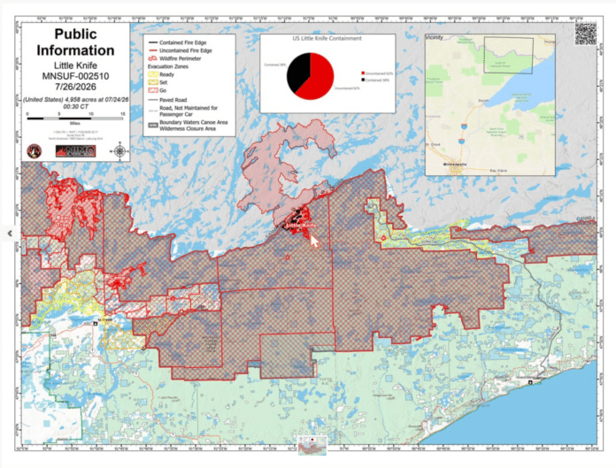
The Forest Service’s emergency closure order shut down BWCAW entry points, several developed campgrounds, trails, boating access sites, interpretive sites, and observation areas. The closed zone spans Cook, Lake, and St. Louis counties. Overnight travel permits into the wilderness were cancelled outright, first through July 29 and likely longer depending on fire behavior. Order 09-09-06-26-07 formally took effect at 12:01 p.m. CT on July 11, with public access to the BWCAW halted on the ground starting July 14. A companion order closed developed recreation sites outside the wilderness on July 15. Both orders run until October 1 on paper. Even so, the agency will rescind either one earlier if conditions improve across the Superior National Forest wildfire closure zone.
A real reopening is happening at the same time. It matters because national coverage tends to flatten this into one blanket shutdown. Since July 27, Cook County entry points began accepting day-use permits again. It is a sign the Gunflint side of the wilderness stabilized faster than the Fernberg corridor near Ely. Lake County still holds GO evacuation orders along the Fernberg. Property owners have started limited, escorted re-entries to check on homes there. St. Louis County lifted its READY and SET zones west of the Echo Trail and around Crane Lake entirely.
Treat an already-booked permit as cancelled until Recreation.gov shows it reinstated. Do not assume a reopened entry point means every route inside it stays safe or accessible. Several interior trails and portages remain closed even where the entry point itself reopened.
Fire Growth, Containment, and Smoke Risk
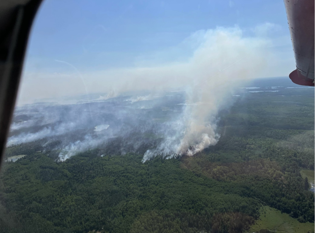
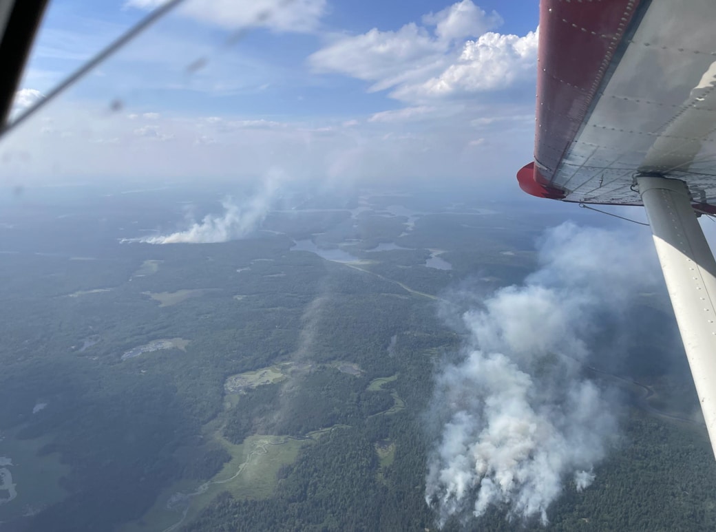
Six fires now carry names and containment percentages. Bear Trap sits at 38 percent, Sioux at 27 percent, and Camp at 23 percent. Thumb sits at 56 percent, Little Knife at 21 percent, and Chub at 95 percent. Ten smaller fires add another 64.4 combined acres, and crews list all ten as fully contained. The Camp Fire, northeast of Ely, held 100 percent containment earlier in July. It then jumped its lines during a stretch of extreme fire weather. This reversal explains why crews resist naming a firm reopening date for this BWCAW wildfire.
However, smoke has been the bigger daily problem for anyone outside the fire perimeter. Minnesota issued Air Quality Alerts rating conditions in the AQI’s second-worst tier over Ely. Communities to the east saw the same alerts during several evenings in mid-July. This Boundary Waters wildfire 2026 event pushed the Minnesota Pollution Control Agency to keep updating its forecast as wind direction shifts. Two fires crossed the international border into Canada. This adds a second country’s smoke output to the same airshed. Governor Tim Walz declared a peacetime emergency on July 12 and activated the Minnesota National Guard. The step reflects both the scale of the fire season and the strain on regional resources.
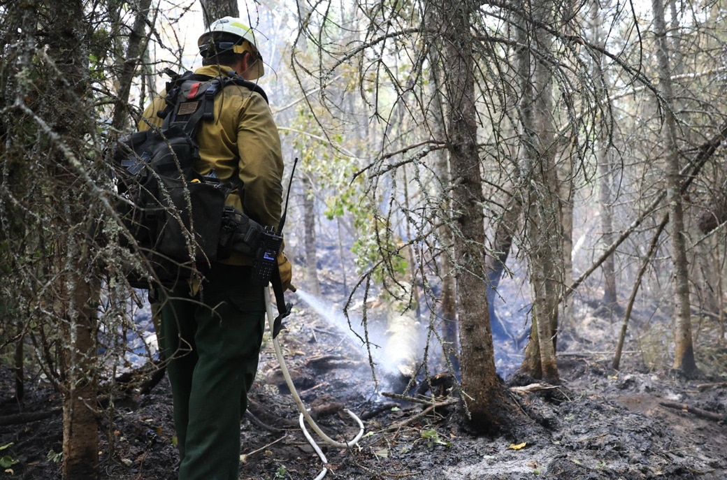
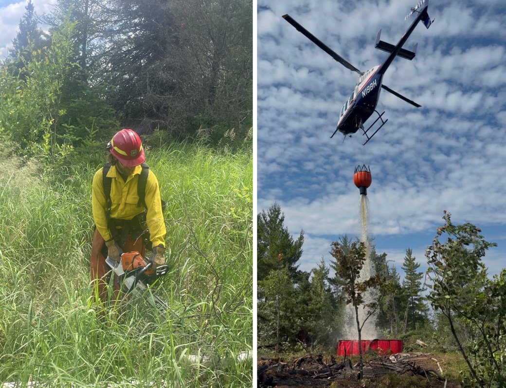
Photos From the Fire Lines
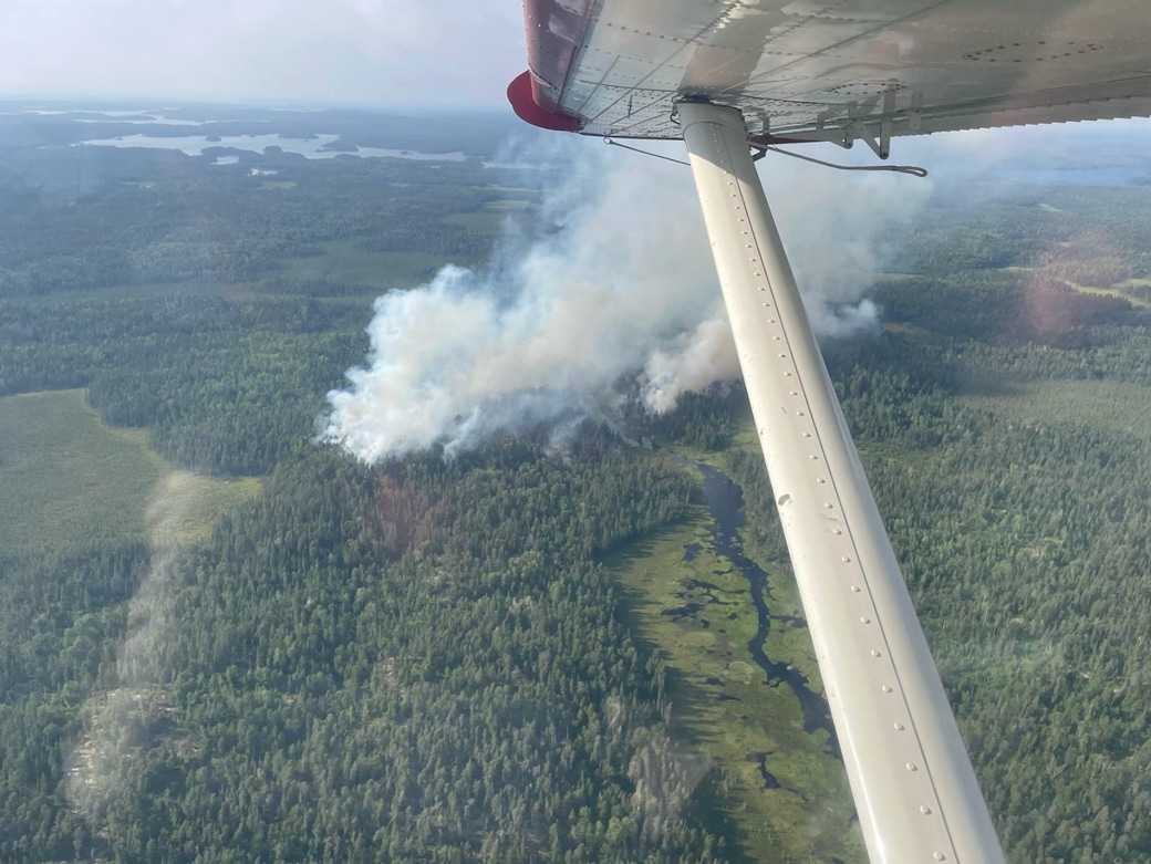
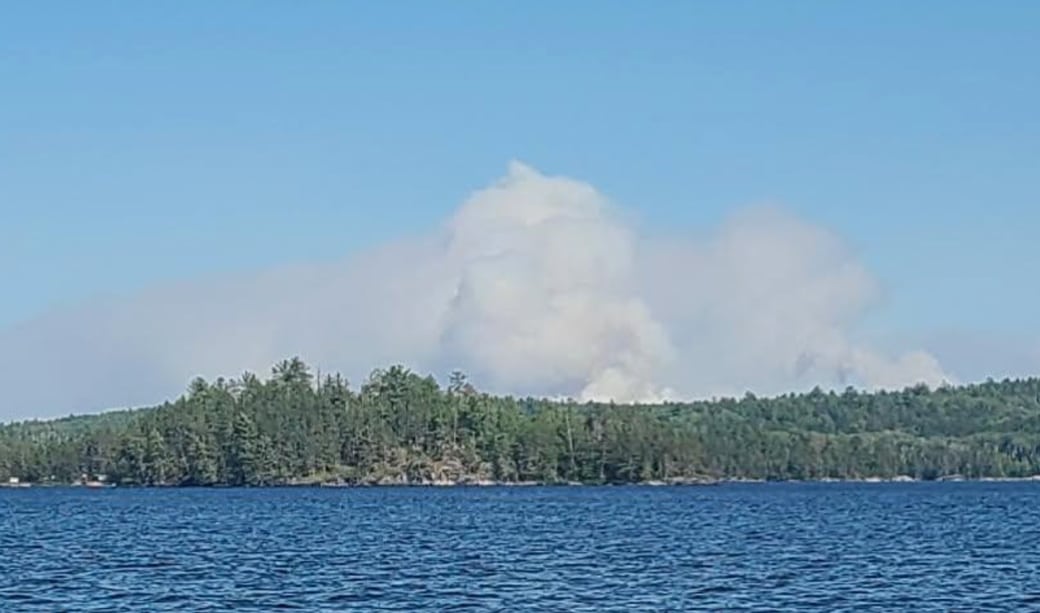
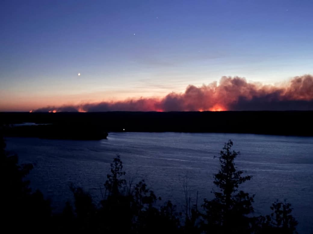
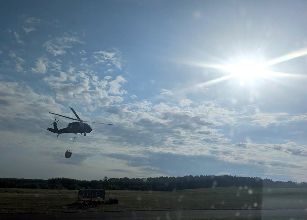
Safety note: wildfire smoke at this alert tier is a real respiratory hazard, not a minor haze. Check the Minnesota Pollution Control Agency’s air quality forecast before you drive into the region. Also limit time outdoors when the index spikes. Turn back if visibility or breathing conditions worsen rather than pushing toward a trailhead.
Gear to Carry If You Reroute
Anyone still driving into northeastern Minnesota this season should treat the trip as a self-sufficiency run. This applies whether you plan a shortened paddle trip on an open lake or an overland loop skirting the closure. Cell coverage was already spotty across most of the Superior National Forest before the fires. Closed roads plus active fire traffic also make it worse. The tech and gear for self-sufficient overlanding apply directly here.
Three items earn their weight for this specific trip. A two-way satellite communicator handles check-ins when cell towers disappear. Also worth packing: a properly rated smoke mask for the days when the air quality index spikes near camp. A handheld air quality monitor gives an independent reading instead of a guess based on haze color. None of these count as exotic gear. Any wildfire-adjacent trip through a Western national forest calls for the same short list, and it packs small enough to live in a door pocket for the rest of the season.
Gear for a Smoke-Affected Trip


The Forest Service recommends a shared travel plan before departure. This guidance means something concrete this week. Tell someone your exact route, your expected check-in times, and your fallback plan if an entry point closes behind you. A satellite communicator turns a note on the fridge into a live two-way channel. This matters since road closures often appear faster than a map app updates.
Planning an Alternate Trip This Season
Most of the Superior National Forest’s developed campgrounds outside the fire perimeter remain open. This point is worth repeating, since the closure headlines make the whole forest sound shut. Check status site by site before committing, since the list changes as containment lines move. The Forest Service app pulls the same alert feed the agency posts online. It also works from a saved cache once you lose signal, the exact moment you need it most.
Routes built around the BWCAW specifically should look west and south instead of waiting out the closure. Several established overland routes through the Chippewa National Forest sit outside the current fire perimeter entirely. So does the Superior Hiking Trail corridor. Our fire season camping guide covers how to vet a replacement route quickly instead of guessing from a paper map.

Jackery Portable Power Station Explorer 300, 292Wh Backup LiFePO4 Battery, Solar Generator for Outdoors Camping Travel Hunting Blackout (Solar Panel Optional)
292Wh of capacity keeps a phone, a fan, and a headlamp charged through a multi-day air quality alert without running a vehicle.
Fire restrictions elsewhere in the region add a second layer to plan around. A rerouted trip often lands under a different set of local rules than the ones left behind. Our guide to 2026 fire restrictions for camping covers this exactly. A campfire ban at a backup site also turns common during a dry summer like this one.
What the Boundary Waters Closure Means for Your Trip
A permit booked before October 1 will likely move or cancel rather than survive a quick reversal. This Boundary Waters wildfire 2026 season keeps proving how fast a “contained” fire flips back into an active one, and crews have every incentive to keep the closure conservative rather than manage a second evacuation.
Even so, this closure runs narrower than it sounds from the outside. The agency peels back restrictions as soon as a specific area earns it, rather than holding the entire forest shut on a single calendar date. Check the alerts page weekly instead of writing off the whole season, and watch specifically for the next entry point to follow Cook County’s lead.
For overlanders passing through rather than paddling in, the biggest practical shift means treating this stretch of northern Minnesota like a remote Western fire zone. Verify air quality before committing to outdoor camping. Carry a way to communicate without cell service. Build a backup route before leaving home instead of improvising one at a closed gate.
The forest will reopen in stages as containment climbs on the six named fires. Chub’s 95 percent containment already shows this pattern on the ground. Watch the Forest Service alerts page directly rather than a single news story. Conditions here shifted within days more than once already this month during this Superior National Forest wildfire closure.
Related Reading
FAQ
When will the Boundary Waters reopen in 2026?
The current order runs through October 1, 2026, though the Forest Service will lift it earlier for specific zones as containment improves. Cook County’s day-use entry points already reopened on July 27. Watch for staged reopenings rather than one single date.
Is it still possible to camp in the Superior National Forest right now?
Yes, in most areas. The closure targets the BWCAW itself along with specific campgrounds, trails, and boating sites in the fire zone. Most developed campgrounds elsewhere in the forest remain open, though confirming status site by site before departure remains wise.
Is the Boundary Waters closure the same as a regional fire ban?
No. This is an area closure tied to active fire perimeters and firefighter safety. It stands separate from any broader fire-restriction order limiting campfires or equipment use across a wider region. Check both before travel, since they carry different rules.
What happens to a permit already booked?
Treat overnight BWCAW permits inside the closed area as cancelled until Recreation.gov shows otherwise. Meanwhile, day-use permits are starting to reopen at select entry points. Check the specific entry point rather than assuming forestwide status.
How do travelers check current smoke and air quality near Ely?
The Minnesota Pollution Control Agency publishes a daily air quality forecast covering the Ely area and communities to the east, and it updates as wind direction shifts the smoke plume. Check it the morning of travel, not the night before.