



Quick Facts:
- Short answer: Mosquito Ridge Road and everything beyond it are closed
- Order: Forest Order 17-26-21, Talbot Fire closure
- Effective: 9:00 a.m. PDT August 14 through December 31, 2026
- Districts: American River and Truckee, two of the forest’s four
- Perimeter roads: Forest Road 22, Forest Road 96, Forest Road 96-62, Forest Road 03
- Trails closed: Western States Trail 16E10 segment, PCT Trail 2000 segment
- Penalty: $5,000 individual, $10,000 organization, up to 6 months
- Map: Exhibit A inside the signed order PDF, linked below
- Ranger district: American River, Foresthill, 530-367-2224
9 min read
In This Guide
- What the Talbot Fire Closure Covers
- Talbot Fire Closure Key Facts
- Where the Closure Line Runs, in Road Numbers
- Stage 2 Restrictions Reach the Whole Forest
- Where to Run and Camp Instead
- Will the Talbot Fire Closure Lift Before December 31?
- What the Talbot Fire Closure Means for Your Weekend
- Frequently Asked Questions
What the Talbot Fire Closure Covers
Mosquito Ridge Road is closed. So is the reservoir behind it, every campground around it, and every spur off it. The Talbot Fire closure took effect at 9:00 a.m. Pacific on August 14, 2026, and runs through December 31. Because the order wraps the whole recreation area, an open route on your MVUM app means nothing inside the line.
The scope stops there, though. Forest Order 17-26-21 is an area closure, not a forest closure. It reaches the American River and Truckee Ranger Districts only, so Sierraville and Yuba River stay open for entry. Forest-wide Stage 2 fire restrictions still apply everywhere, which the next section covers.
Rather than gating a few segments, the order draws a polygon and bans five separate acts inside it:
- Going into or being upon National Forest System lands in the closure area
- Being on any National Forest System road in the closure area
- Being on any National Forest System trail in the closure area
- Being on the Pacific Crest Trail between the Placer County 9001 Road trailhead and Barker Pass Trailhead
- Being in any National Forest System recreation site in the closure area
Only three groups are exempt under 36 CFR 261.50(e). The list covers federal, state or local officers and organized rescue or firefighting members on official duty. It also covers holders of Forest Service Permit FS-7700-48. Finally, it covers owners, lessees and residents of private land, to the extent needed to reach their property.
Where the Fire Stands
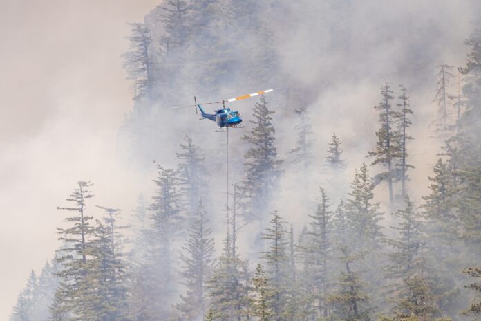
The fire itself stayed small. According to CAL FIRE, the incident sat at 91 acres with 25 percent containment on August 14. The day before it measured 75 acres. Officials attribute the acreage jump to a new infrared flight and previously unmapped spot fires, not to fresh growth. Roughly 412 personnel now work the incident, in heavy timber on extremely steep ground near the Granite Chief Wilderness. An evacuation warning remains active for Talbot Fire Zone 1, although the Cedars community warning has lifted.
Talbot Fire Closure Key Facts
| Item | Detail |
|---|---|
| Authority | 16 U.S.C. 551; 36 CFR 261.50(a) and (b) |
| Signed | Nevada City, California, Aug. 14, 2026 at 8:00 a.m. |
| Fire size | 91 acres, 25% contained (Aug. 14 update) |
| Ignition | Aug. 12, 2026, 3:26 p.m., cause under investigation |
| Location | 4 mi NE of French Meadows Reservoir, 14 mi SW of Truckee |
| Personnel | 412 assigned, Sacramento Regional Type 3 team |
| Incident contact | 2026.Talbot@firenet.gov |
Stage 2 rules and a moving closure line make current information the scarce resource this weekend. These three cover the gap when agency pages lag and cell service disappears.
| Top Pick | Best Budget | Best Mapping | |
|---|---|---|---|
| Product | TOP PICK Garmin inReach Mini 2 Garmin inReach Mini 2 |  Midland MXT275 GMRS Midland MXT275 GMRS |  Garmin Tread Overland Garmin Tread Overland |
| Rating | ★★★★☆ 4.6 2,200 ratings | ★★★★☆ 4.6 1,800 ratings | ★★★★☆ 3.9 44 ratings |
| Works without cell service | Satellite, global | Radio, line of sight | Offline maps only |
| Best use | Two-way SOS and check-in | Convoy and trail comms | In-dash route planning |
| Price | $324.00 as of Oct 1, 7:05 pm | $199.99 as of Oct 1, 9:20 pm | $1,099.99 as of Oct 1, 10:39 pm |
| Check Price → | Check Price → | Check Price → |
Where the Closure Line Runs, in Road Numbers
The order describes its boundary in township and range language, which helps nobody planning a trip. Translated into road numbers, the perimeter starts where Forest Road 22 crosses the Tahoe National Forest boundary. The line then runs northeast on 22 to Forest Road 96, the Mosquito Ridge Road. From there it goes northwest along 96 to Forest Road 96-62.
From 96-62 the perimeter turns northeast to the Western States trailhead. It then runs east on Western States Trail 16E10 to the Granite Chief Wilderness boundary. It follows the wilderness line southeast to the forest boundary, then drops south to Forest Road 03, the Barker Pass Road. The last legs run west on 03, north on 03-06, west on 03-06-02, and back along the wilderness and forest boundaries to the start.
One caution about those perimeter roads. The order defines them as the closure line, then separately bans travel on any National Forest System road inside the area. Whether a given mile of Forest Road 96 sits on the line or inside it depends on the mapped polygon. Read Exhibit A in the signed order before assuming a segment stays legal. The forest has not published a milepost for the gate. Call the American River Ranger District at 530-367-2224 if your route threads the edge.
The PCT Segment Is Separately Named
Beyond the polygon, the order shuts a Pacific Crest Trail segment. Trail 2000 closes between the PCT trailhead on Placer County 9001 Road and Barker Pass Trailhead. Thru-hikers and section hikers therefore need a reroute now. Since the order runs to year end, the detour outlasts hiking season.
Official Recreation Pages Are Stale
Here is the trap. The Forest Service recreation page for the corridor still lists five campgrounds as open. Those are Ahart, Coyote Group, French Meadows, Gates Group and Lewis. Its last update stamp reads March 17, 2025. Recreation.gov, by contrast, has caught up. The French Meadows and Lewis listings carry a wildfire notice and show sites closed from August 14. Anyone holding a reservation should check the listing and cancel through Recreation.gov rather than assume an automatic refund.
Safety note: An evacuation warning remains in place for Talbot Fire Zone 1. Crews are also falling hazard trees along the same roads. Driving in puts you on single-lane mountain roads shared with dozers, water tenders and engines. Turn around at the closure signs.
Stage 2 Restrictions Reach the Whole Forest
The closure itself touches half the forest. A second set of orders signed one day earlier reaches every corner of it. Acting Forest Supervisor Matt Lane signed Orders 17-26-17 through 17-26-20 on August 13. All four ranger districts now sit under Stage 2 fire restrictions. Those restrictions run from August 14 through October 31, 2026.
Two provisions matter most to anyone running a rig. First, the orders ban any fire, campfire or stove fire. The single exception is a grill or ring provided at one of 31 host-serviced campgrounds. Second, the orders bar internal combustion engines off paved, gravel or dirt roads and trails. One carve-out covers the Prosser Pits Developed OHV Area. Boats stay exempt as well.
A California Campfire Permit does not buy you out of the campfire ban. Instead, it authorizes a gas, kerosene or pressurized liquid fuel stove or lantern with a shut-off valve. You still need a three-foot cleared area. Smoking rules tighten too, so keep it inside an enclosed vehicle or building, at a listed campground, or in a cleared circle. Our 2026 Western fire restrictions guide covers how these stages differ across ten states.
One quirk deserves flagging. French Meadows Campground appears on the Stage 2 list of campfire-legal sites, because the drafters wrote the list a day before the closure landed. Since the campground sits inside the Talbot Fire closure footprint, ignore the listing. The closure order supersedes it.
Pulling Off the Road to Camp Under Stage 2
Read the engine provision carefully before you pull off a road to camp. Because Stage 2 bars off-route operation, driving 30 feet into an unmarked pullout is exactly the act it prohibits. Established sites reached without leaving the designated route stay usable. The American River Ranger District confirms a specific spot.
Where to Run and Camp Instead
| Destination | District | Off-route driving | Campfire legal? |
|---|---|---|---|
| Prosser Pits OHV Area | Truckee | Legal, only site on forest | Yes, at Prosser Family CG |
| Bear Valley OHV Loop | Sierraville | Designated routes only | No, stove only |
| Boca and Stampede | Truckee | Designated routes only | Yes, at listed sites |
| Sugar Pine and Big Reservoir | American River | Designated routes only | Yes, four host-served sites |
| Rubicon Trail | Eldorado NF | Trail route only | No, forest-wide ban |
Prosser Pits, Bear Valley and Sugar Pine in Detail
For wheeling, Prosser Pits is the obvious answer. Under Stage 2, it is the only spot on the forest where off-route engine operation stays legal. Prosser Family Campground nearby holds a campfire exemption. Truckee District access keeps you well east of the closure line.
For a longer loop, the Bear Valley OHV system on the Sierraville District runs roughly 18 miles. It welcomes all OHV types and has a 10-site campground alongside it. Bear Valley Campground does not appear on the Stage 2 list, so plan on a stove there. Boca and Stampede offer the short Boca Hill OHV Trail plus Boca Springs Campground. However, Boca and Boca Rest both showed closed status at our check.
Sugar Pine and Big Reservoir keep American River District options alive without touching the closed corridor. Big Reservoir, Giant Gap, Shirttail Creek and Morning Star all carry host service, so fires stay legal at those four. Since the Sugar Pine OHV system opens and closes with weather, call 530-367-2224 ext. 228 first. Readers hunting free sites farther out should start with our guide to free dispersed camping in Northern California.
Every alternative above sits under the same forest-wide campfire ban, so dinner comes off a shut-off-valve stove rather than a fire ring. These three keep a legal camp kitchen and a warm tent through the closure window.
| Top Pick | Best Compact | Best for Cold Nights | |
|---|---|---|---|
| Product | TOP PICK Camp Chef Everest 2X Camp Chef Everest 2X |  Jetboil Flash Jetboil Flash | 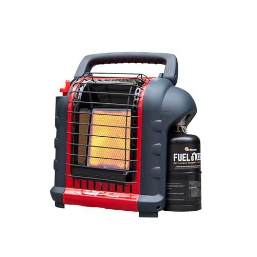 Mr. Heater Portable Buddy Mr. Heater Portable Buddy |
| Rating | ★★★★☆ 4.6 500 ratings | ★★★★★ 4.8 4,100 ratings | ★★★★★ 4.7 29,200 ratings |
| Use case | Full camp meals | Solo boil | Tent and awning heat |
| Rated output | 40,000 BTU | Not listed | 9,000 BTU |
| Price | $212.44 as of Oct 1, 6:24 pm | $89.97 as of Oct 2, 2:36 am | |
| Check Price → | Check Price → | Check Price → |
Will the Talbot Fire Closure Lift Before December 31?
Probably, at least in part. Area closures follow a specific incident, wrap a mapped polygon, and lift by rescission once crews finish. Forest closures, in contrast, follow extreme conditions across an entire unit and shut everything at once. Because Forest Order 17-26-21 belongs to the first category, expect staged reopening ahead of the printed date. A 91-acre fire at 25 percent containment points the same way.
Precedent supports the same read. A near-identical order on the Malheur National Forest carried the same year-end expiration while crews worked a fire more than a thousand times larger. Orders like it routinely shrink in stages as hazard trees come down and crews demobilize. Our coverage of a similar closure through December 31 walks through how those rescissions arrive. For the wider picture, see other federal fire closures this August.
Do not plan around an early lift, however. The printed date is the only one with legal force, and rescissions arrive without warning. Watch the Tahoe National Forest alerts page, since it carries the order status first and the campground listings follow.
What the Talbot Fire Closure Means for Your Weekend
Treat this as a season loss rather than a weekend loss. December 31 erases fall color, most of deer season and every remaining summer weekend in the basin. Foresthill-based trips therefore need a new destination, not a new date.
If you had a French Meadows or Lewis reservation, cancel it through Recreation.gov. Confirm the refund rather than waiting for one. Anyone running Forest Road 96 as a through route needs a route on the Foresthill side of the line, and Exhibit A comes first. Trips elsewhere on the forest survive, although your fire ring does not.
Alternatives carry their own rules, which the table above lays out. Prosser Pits is the single legal option for off-route driving, and Sugar Pine keeps you closest to Foresthill. Readers willing to drive farther will likely find better solitude, because the open districts absorb whatever traffic the closure displaces.
Verify before you tow. Forest Service recreation pages lag by months, while the alerts page, the signed order and the Recreation.gov listings all carry current status. Smoke reaches the alternatives too. Read our take on whether wildfire smoke should cancel the trip before committing fuel and vacation days.
Frequently Asked Questions
Is French Meadows Reservoir closed because of the Talbot Fire?
Yes. The reservoir sits inside the Talbot Fire closure boundary, and the order closes every National Forest System recreation site inside the line. The closure runs through December 31, 2026 unless the forest rescinds it earlier.
Is Mosquito Ridge Road closed right now?
Yes. Forest Road 96 forms part of the closure perimeter, and the order separately bars travel on any National Forest System road inside the area. Read Exhibit A in the signed order to see which segments fall inside the line, or call the American River Ranger District at 530-367-2224.
When does the Talbot Fire closure end?
The order expires December 31, 2026. However, forests frequently rescind incident closures in stages once containment climbs and hazard trees come down. Watch the Tahoe National Forest alerts page for partial reopenings.
Is the whole Tahoe National Forest closed?
No. This is an area closure affecting the American River and Truckee Ranger Districts only. Sierraville and Yuba River districts stay open. However, forest-wide Stage 2 fire restrictions apply everywhere through October 31, 2026.
What is the fine for entering the Talbot Fire closure area?
A violation carries a fine of up to $5,000 for an individual or $10,000 for an organization. The order also allows imprisonment of up to six months, or both. The authority comes from 16 U.S.C. 551 and 18 U.S.C. 3559, 3571 and 3581.
Are campfires still allowed in Tahoe National Forest?
Only inside a grill or fire ring provided at one of 31 host-serviced campgrounds listed in the Stage 2 orders. A California Campfire Permit does not exempt you from the ban. Instead, it authorizes a shut-off-valve stove or lantern in a three-foot cleared area.
Related Reading
Primary sources for this report include the Tahoe National Forest closure alert and signed order and the forest’s Stage 2 fire restrictions page. Fire size, containment and personnel figures come from the CAL FIRE Talbot Fire incident page, checked August 14, 2026.