


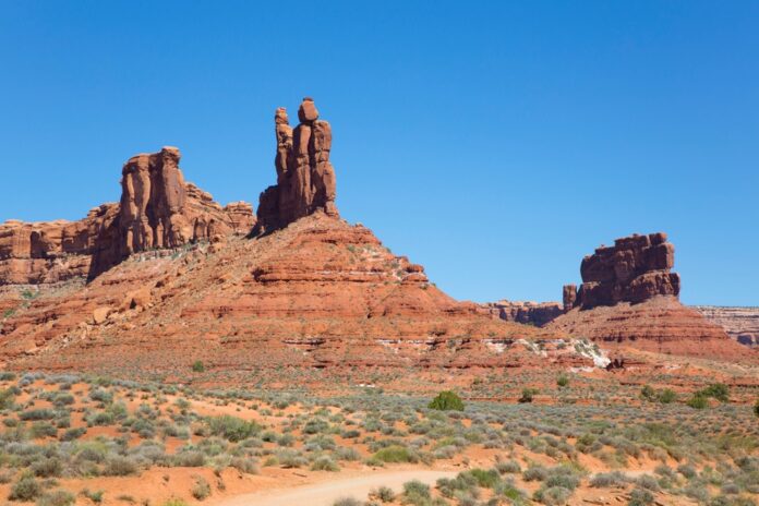

Quick Facts:
- What happened: Two proclamations signed Monday, July 13, 2026
- Monuments affected: Bears Ears National Monument and Grand Staircase-Escalante, both in Utah
- Acres removed: Roughly 2.93 million, reported as nearly 3 million
- New Bears Ears size: About 121,096 acres, in the Shash Jaa and Indian Creek units
- Bears Ears motorized access: No instant reopening; route decisions come later
- Legal authority: Antiquities Act of 1906
- Industry response: SEMA and ORBA in favor
- Opposition: SUWA and conservation groups plan a court challenge
8 min read
In This Article
Overview
On Monday, July 13, 2026, President Trump signed two proclamations reshaping Bears Ears motorized access and shrinking two of Utah’s best-known national monuments. For off-road drivers, the headline question stays simple. Which roads and trails open up, and when? The short answer depends on future agency decisions, not the signature alone. Agency choices also control which routes reach the final map.
The action targets Bears Ears and Grand Staircase-Escalante. Together, the two proclamations remove roughly 2.93 million acres, reported as nearly 3 million acres. Bears Ears itself now covers about 121,096 acres, split between the Shash Jaa and Indian Creek units. Meanwhile, the legal fight over these boundaries is already taking shape.
This explainer sticks to the verified record. First, we cover what the proclamation changed on paper. Next, we translate it into practical terms for people who drive trails. Then we walk through the new route-planning process and the court challenge ahead.
One point matters up front. The order does not automatically reopen every route, and it does not erase protections for archaeological sites, Tribal cultural resources, or wildlife habitat. Instead, it changes the rules the agencies follow when they draw the map.
Key Facts at a Glance
| Detail | Figure |
|---|---|
| Date signed | Monday, July 13, 2026 |
| Monuments affected | Bears Ears and Grand Staircase-Escalante, Utah |
| Total acreage removed | About 2.93 million acres, nearly 3 million |
| New Bears Ears size | About 121,096 acres |
| Bears Ears units | Shash Jaa and Indian Creek |
| Legal authority | Antiquities Act of 1906 |
| Next step for access | New transportation plan from BLM and Forest Service |
| Industry response | SEMA and ORBA applauded the move |
| Opposition | SUWA and conservation groups plan a court challenge |
What the Bears Ears Proclamation Changed
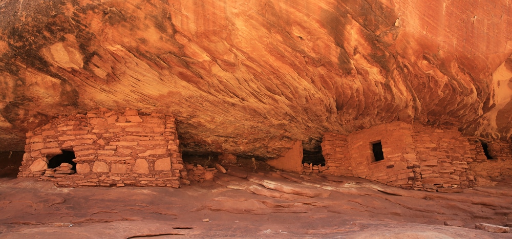
The 2016 Bears Ears designation set aside a large block of federal land under the Antiquities Act of 1906. Under this law, a president is able to create a monument, yet the reserved land must be the smallest area compatible with protecting the objects inside. The new proclamation leans on this smallest-area standard to justify a much smaller footprint. The courts also weigh this same standard while they review a monument boundary.
Here is the recent timeline. President Obama created Bears Ears in 2016. Trump shrank it in 2017. Then Biden restored the larger boundaries in 2021. Now the 2026 order pulls the boundaries back in again.
Inside the reduced Bears Ears, two units remain, Shash Jaa and Indian Creek. The combined acreage sits near 121,096 acres. For context, the earlier boundaries covered well over a million acres. Land dropped from monument status returns to general federal management, mostly under the Bureau of Land Management and the U.S. Forest Service. A large share of the land also shifts back to multiple-use rules because the monument shrank. The reduction also touches Grand Staircase-Escalante, since both areas fell under the same review.
Importantly, the proclamation keeps protections for cultural and archaeological resources in place. It also revises the monument advisory committee. Specifically, the committee now includes an outdoor recreation seat, and off-highway vehicle users or commercial recreation providers qualify for it.
What It Means for Bears Ears Motorized Access
Here is the part off-road drivers care about. Bears Ears motorized access does not flip on overnight. Instead, the proclamation sets a process, and the real decisions land later with the agencies.
While the agencies write the new route plan, they keep discretion over existing routes. They are able to allow motorized and non-motorized use on roads and trails open for such use right before the original 2016 designation. In addition, they are able to maintain those routes and add new ones, including routes closed to vehicles before 2016. A spur trail open before 2016 might also return to the map.
This is a meaningful shift for OHV access. Before, the 2016 framework pointed toward tighter limits. Now the order tells agencies to consider maintaining and improving access for recreation and hunting.
Still, discretion is not a guarantee. The text leans on agency choice, so nothing is mandatory. Practical OHV access depends on how the Bureau of Land Management and the Forest Service designate routes on the ground. You should also watch the travel-management decisions closely.
For a broader view of how federal route decisions play out, see our explainer on off-road access on national forests. The same agency process shapes trails well beyond Utah.
The New Transportation Plan and OHV Routes
The core of the order is a new route-planning effort. Through the Bureau of Land Management and the Forest Service, the proclamation directs the Interior and Agriculture Departments to build a plan endeavoring to maximize public land access. This new transportation plan designates roads and trails for motorized and non-motorized use, and it commits the agencies to maintenance. The plan must also weigh both vehicle travel and quiet recreation.
Because route designation drives everything, this document deserves attention when it opens for public comment. For example, a trail left off the map stays closed, while a trail added to the map opens to travel. The map is the outcome, not the proclamation. The comment period therefore carries real weight for anyone who rides here. Public input also shapes the final route list, so early comments matter.
The order also tells agencies to authorize traditional uses, recreation, and public land access to the greatest extent allowed by law. Any restrictions should stay narrowly tailored, per the text.
Utah already has ambitious trail ideas in motion, such as Utah’s proposed High Desert Trail. Route plans like these show how quickly a paper corridor turns into real miles. If you camp off these routes, our guide to dispersed camping across public land covers the ground rules.
Notably, the advisory committee reshuffle matters here too. An OHV or commercial recreation voice at the table shapes how the agencies weigh access against protection. Hunters and campers likewise gain a clearer seat in the process.
What Happens Next: The Legal Challenge Ahead
Two tracks now run in parallel. On one track, the agencies begin route planning. On the other, the courts prepare for a fight.
The off-road industry welcomed the order. Specifically, SEMA and the Off-Road Business Association applauded the July 13 action as a win for responsible motorized recreation. Their argument stays consistent. Back in 2021, SEMA opposed the Biden restoration, and in 2024 both groups warned the proposed Bears Ears management plan might close areas to OHV use. They also flagged proposed closures during the 2024 review.
Opponents see it differently. The Southern Utah Wilderness Alliance calls the reductions illegal, and conservation groups plan to challenge the move in court. Their core claim rests on the Antiquities Act, since the same smallest-area language cuts both ways in litigation. Tribal and conservation advocates also point to cultural and archaeological resources as reasons to keep the larger boundaries. Supporters instead read the same law as grounds for a smaller footprint.
So what should a trail user watch? First, track the route-designation process and its comment periods. Second, follow the court docket, because an injunction might freeze changes. Meanwhile, ground conditions stay mostly the same until the agencies act.
For trip planning, the new Forest Service app helps you confirm current route status before you go. Rules on paper and gates on the ground do not always match, especially during a legal fight. Always verify a route before you commit your rig to it.
Final Thoughts
Where does this leave the off-road community? For now, expect motion without instant change. The 2026 order rewrites the rules, yet the trail map still runs through agency offices and, likely, a courtroom. Momentum still tilts toward more route access.
The practical takeaway is patience plus attention. Bears Ears motorized access will rise or fall on route-designation decisions, not on the signing ceremony. If you ride or wheel in southern Utah, the public comment windows are where your voice counts most. A single designation meeting might also decide a favorite loop.
It also helps to hold both realities at once. Supporters see restored public land access and a stronger recreation voice, while opponents see weakened protection and a likely unlawful cut to the national monument boundaries. Both sides now aim at the same route map and the same court.
Until the dust settles, plan trips off confirmed-open routes, respect closures around cultural and archaeological sites, and check current status before you roll out. The story is far from over, and the details will decide who is right.
Frequently Asked Questions
Does the proclamation immediately reopen Bears Ears trails?
No. The order sets up a new route-planning process first. Until the agencies finish it, existing rules mostly hold, though the Bureau of Land Management gains room to reopen or add routes.
How much land did the two proclamations remove?
Together, they cut roughly 2.93 million acres, often reported as nearly 3 million acres. Bears Ears now covers about 121,096 acres across the Shash Jaa and Indian Creek units.
What does the change mean for OHV access specifically?
It shifts the direction toward maintaining and improving access, yet nothing is automatic. Real OHV access still depends on how the agencies designate roads and trails on the ground.
Are Tribal and archaeological protections still in place?
Yes. The proclamation keeps protections for archaeological sites, Tribal cultural resources, and wildlife habitat. It narrows the monument, but it does not strip those safeguards.
Will the reductions hold up in court?
Unclear for now. Conservation groups, including the Southern Utah Wilderness Alliance, call the cut illegal and plan to sue under the Antiquities Act. A judge might pause changes while the case proceeds.
What should I check before driving there?
Confirm current route status through official sources, since paper rules and on-the-ground gates do not always line up. Also respect posted closures near cultural and archaeological sites.