



I’ve been running multi-day desert routes for close to a decade. The mistakes I’ve made in those years all shared one root cause: I planned those trips the same way you’d plan a mountain trail. Desert terrain doesn’t play by the same rules, especially on multi-day routes. For example, misreading a fuel gap, underestimating water, getting stuck in a sandy wash bottom: each came back to the same flawed assumption. A desert route plan has to account for heat windows, water logistics, and navigation margins your mountain plan never needed. This includes margins for fuel scarcity and extreme temperatures.
At 4WDTalk, we cover gear and technique for real conditions, not only the easy days. I’ve put the MORRFlate TenSix PSI Pro Gen 2 through multiple long desert runs. Firsthand, I learned how your air management system becomes central to route planning. When you’re airing down and back up across ten or fifteen legs, for example, a slow compressor reshapes your whole schedule. This guide is the planning framework I use before any serious multi-day desert run. It’s built from those trips and the gaps I found in every other planning resource out there.
Quick Facts:
- Topic: Multi-day desert overlanding route planning
- Terrain covered: Sandy washes, hardpan, canyon rock, corrugated desert roads
- Region focus: American Southwest (Utah, Arizona, Nevada, New Mexico)
- Skill level: Intermediate (some off-road experience assumed)
- Key logistics: Water (1+ gallon per person per day minimum), fuel gaps up to 150+ miles, BLM dispersed camping
- Air management: MORRFlate TenSix PSI Pro Gen 2 recommended for multi-leg routes
- Navigation tools: Gaia GPS or onX Offroad with downloaded offline maps
- Best seasons: March through early June, September through November for most Southwest desert routes
9 min read
In This Guide
- Why Desert Overlanding Route Planning Is Different
- How to Build Your Route Segment by Segment
- Desert Overlanding Water Logistics: The Non-Negotiable
- Fuel Gaps and Range Planning
- Heat Windows and Timing Your Drive Days
- Tire Pressure Management Across Remote Legs
- Navigation and Offline Maps
- Permits, BLM Land, and Campsite Selection
- Pros and Cons of Desert Overlanding
- Final Verdict
- Frequently Asked Questions
Why Desert Overlanding Route Planning Is Different

Most desert overlanding guides treat route planning as a gear problem. Bring enough gear, follow the track, camp somewhere scenic. The approach works reasonably well in the Pacific Northwest or the Rockies, especially where water is plentiful and temperatures stay moderate. In contrast, the Southwest desert requires a fundamentally different approach.
The desert has three variables (water, heat, and distance) where any one of them going wrong turns an inconvenience into an emergency. Water sources, for instance, are scarce and often unreliable. Temperatures in Utah or Arizona routinely exceed 100°F from June through August, which changes how your engine, your tires, and your body perform. Fuel gaps between gas stations on desert routes frequently exceed 100 miles, including some gaps exceeding 150 miles. Planning for a desert overlanding route means treating these three variables as design constraints, especially water and fuel, not afterthoughts.
The good news is a desert route planned well is among the most rewarding overlanding experiences available anywhere in the country. White Rim Road in Canyonlands, the Mojave Road across the California desert, the Coronado Trail through Arizona: these routes exist in a category of their own. Scenery, solitude, and challenge define them, especially compared to crowded mountain trails. The planning framework below is what makes them achievable and safe.
How to Build Your Route Segment by Segment
Start with your endpoints, not your waypoints. To illustrate the process: pick where you’re starting and where you’re finishing. Then identify your hard constraints, including gas station locations, the temperature forecast for your window, and any segments seasonally closed. These constraints shape everything else.
From there, divide the route into daily segments. Desert driving is slower than map mileage suggests, especially on sandy or rocky terrain. A conservative planning estimate is 50–80 miles per day on rough desert tracks, adjusted for your rig’s capability and the specific terrain. On maintained gravel, for example, 100–120 miles per day is realistic. In contrast, technical canyon terrain or deep sand limits you to 30–40 miles per day.
Mark your escape routes as you build each segment. In the desert, an escape route is a paved or maintained road within range of your segment when conditions change, especially during monsoon season. Monsoon storms in Arizona and New Mexico between July and September cause flash flooding closing washes with almost no warning. Building escape-route awareness into the route from the start means you have options when you need them, instead of searching for alternatives under pressure.
A useful desert overlanding checklist starts here: cross-check each segment against Bureau of Land Management (BLM) and Forest Service closure records. Both agencies post seasonal closures online. For Utah, the BLM Utah website lists road conditions by district. For Arizona, the Tonto National Forest site covers the Coronado Trail and other Forest Service roads. These closures are not always updated in real time. Calling the local BLM field office the week before your trip is worth the five-minute call.
Desert Overlanding Water Logistics: The Non-Negotiable
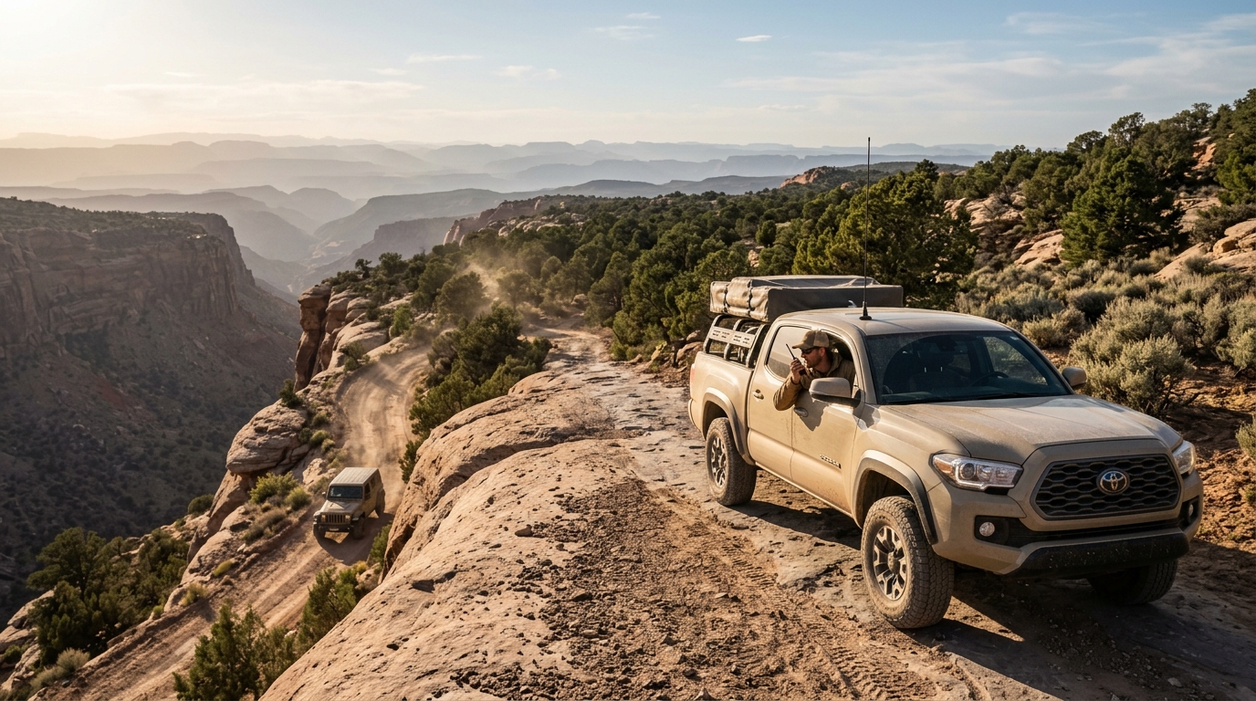
The commonly cited planning figure is 1 gallon of water per person per day for survival. However, those figures are a minimum for sedentary conditions. On a desert overlanding trip, you’re working physically: digging, winching, changing tires, setting up camp. In warm conditions, plan for 1.5 to 2 gallons per person per day. Above 95°F, increase to 3 gallons per person per day. For a two-person, four-day spring trip to the Arizona desert: 12 to 24 gallons of drinking and cooking water, separate from water for washing.
Vehicle-mounted water storage is the baseline, especially for routes beyond two days. A 5-gallon water jug is inadequate for a serious multi-day desert run. Most experienced desert overlanders run at least two 7-gallon water containers or a dedicated 20–30 gallon water tank. BPA-free polyethylene tanks like those from RotopaX or Scepter are standard; price range for a 20-gallon dedicated tank runs $150–$300 installed, depending on mounting setup.
Desert springs and seasonal streams are not reliable water sources on a desert overlanding route. Many are seasonal and dry by late spring. Some carry bacteria, parasites, or mineral contamination at levels a standard water filter won’t address. Treat any desert water source as a backup, not a supply point, and carry filtration plus chemical treatment as redundancy.
Plan your water resupply points before you leave. Some remote desert towns have water available at a tap outside the fire station or general store; calling ahead confirms this. BLM campgrounds along popular routes occasionally have potable water, the White Rim area has none, for example, while some sites along the Mojave Road have cached supplies maintained by volunteers. Know exactly what’s available on your specific route before you go.
Fuel Gaps and Range Planning
Fuel gap planning for desert routes starts with the honest range of your vehicle, not the manufacturer’s combined-cycle estimate. Real-world off-road fuel consumption on rough terrain runs 20–40% higher than highway fuel economy, depending on driving speed, 4WD engagement, and load. A truck rated at 18 mpg highway gets closer to 11–14 mpg on technical desert terrain. Calculate your planning range from this figure.
For gaps exceeding your safe planning range, you have two options: carry auxiliary fuel or identify intermediate resupply points. Auxiliary fuel containers in 5-gallon and 10-gallon sizes, including brands such as Wavian or Rotopax, run $40–$100 each. A pair of 10-gallon containers adds 20 gallons and roughly 220–280 miles of additional range on a truck getting 11–14 mpg off-road.
On the route, mark fuel stops in your navigation app the same way you mark campsites, especially when station hours are limited. Use Gas Buddy or GasPrices.com to confirm the station is still open; remote desert stations close with no advance notice. For longer routes, note the hours of each station, since many rural desert towns have stations open only from 7 a.m. to 6 p.m. Arriving at a closed pump 80 miles from the next option is an avoidable problem.
Heat Windows and Timing Your Drive Days
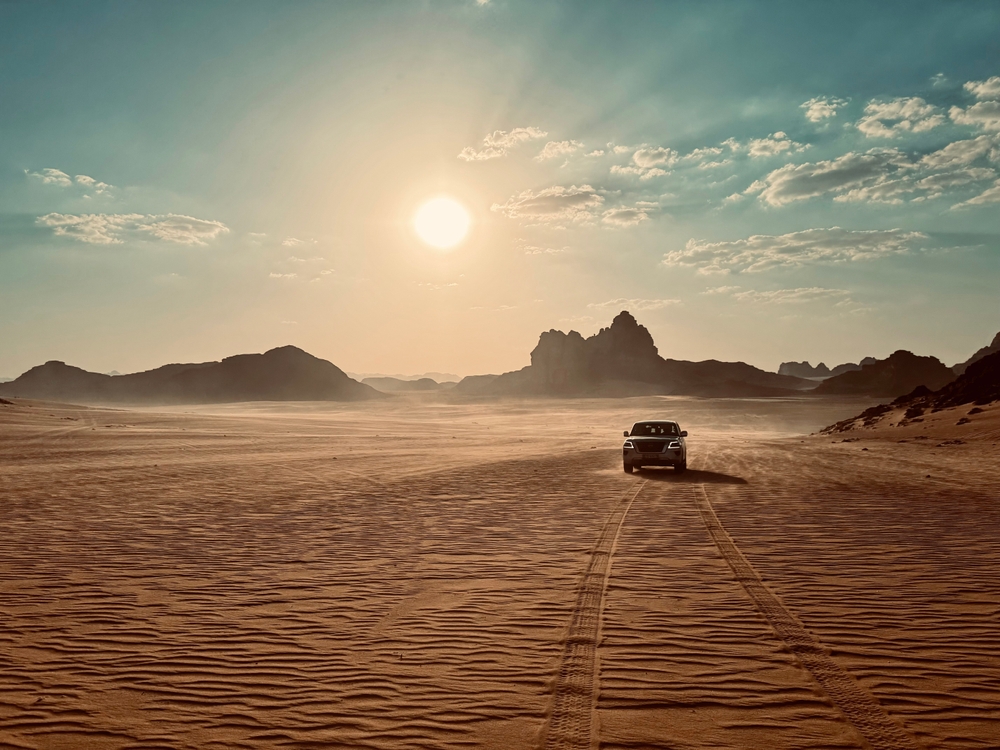
Desert heat management is a driving schedule problem, not a gear problem alone. In the Utah and Arizona desert from late spring through September, temperatures above 90°F typically arrive by 10 a.m. and persist until 6 p.m. or later. Running a heavily loaded truck up canyon climbs in those conditions pushes coolant temperatures higher than normal, especially with low-speed crawling on technical terrain.
Above all, plan driving days to front-load the difficult sections. Start moving at first light when temperatures are coolest. Tackle the technical or exposed terrain before 10 a.m., and plan to be at camp or in shade by early afternoon. This schedule requires getting into camp the previous evening early enough to prepare for the next morning’s early start, for example by limiting afternoon driving distances.
One of the most overlooked desert off-road tips: monitor your coolant temperature gauge on desert climbs. Most trucks run comfortably below the midpoint of the gauge even on steep climbs in moderate weather. On a long desert ascent in 100°F ambient temperature, the gauge reading mid-range or slightly above is worth noting. If it climbs toward the red, pull over and point the truck into any available breeze. Then let it idle with the heater on full blast to pull heat from the engine. Turning off the engine on a hot motor is worse than letting it idle, since the cooling system stops circulating.
Tire pressure increases with heat. A tire inflated to 35 PSI at 70°F ambient temperature runs approximately 38–40 PSI at 100°F ambient, an increase of roughly 1 PSI per 10°F. On a desert route where you’ve aired down for terrain, check your pressures in the cool of the morning. Checking after hours of driving in the heat gives you a false high reading.
Tire Pressure Management Across Remote Legs
A multi-day desert overlanding route typically runs five to fifteen distinct terrain types, each with a different optimal tire pressure. Sandy washes call for maximum airing down, for example 15–18 PSI on 35″ tires to maximize footprint and prevent digging in. In contrast, hardpan and rough gravel road benefit from a moderate 22–26 PSI. Rocky ledge terrain where you need sidewall protection runs 25–30 PSI. And every time you return to pavement, you air back up to 35 PSI or higher before driving at speed.
Compressor Speed and Multi-Leg Routes
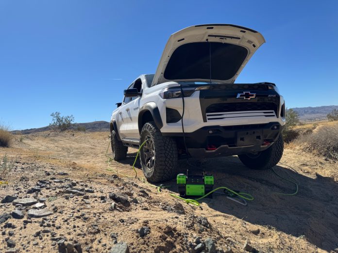
Over a four-day desert route, you might face two to four significant terrain transitions per day, including sandy washes and rocky ledges. In total, you’re airing down and back up eight to sixteen times. A slow compressor, anything under 6 CFM, turns each of those inflation stops into a 20-minute wait per vehicle. On a group trip, the difference is arriving at camp before dark or after it.
I run the MORRFlate TenSix PSI Pro Gen 2 for two reasons. First, it runs 10.6 CFM at 0 PSI. Second, it fills four 35″ tires simultaneously in under five minutes with the Quad hose kit. Its 80% duty cycle handles back-to-back sessions across multiple vehicles without thermal shutdown. On a solo trip, it makes inflation stops inconsequential. On a group trip, one TenSix keeps pace with six vehicles across a full day of terrain transitions.
Before your first desert run, read through the tire pressure mistakes to avoid in desert conditions. The consequences of wrong pressure in heat and soft terrain are more immediate than most drivers expect.
Gear We Use
Air Up Four Tires in Under 5 Minutes
The MORRFlate TenSix PSI Pro Gen 2 runs 10.6 CFM with an 80% duty cycle and a 3-Year No Hassle Warranty. Built for multi-leg desert routes.
Navigation and Offline Maps
Among the most important desert off-road tips: cell service is absent across most serious desert overlanding routes. Gaia GPS and onX Offroad both support offline map downloads, and downloading your entire route area before you leave is non-negotiable, not optional. Download a buffer 30–40 miles wider than your planned route on each side, for example to cover navigation adjustments and detours.
Mark your route in the app before you leave, not when you’re trying to find it in the field. Add waypoints for your campsites, fuel stops, water sources, and escape routes, especially water sources you’ve pre-verified. In the desert, a waypoint for a spring or tank is only useful if you’ve verified in advance whether it’s reliable for your season. Overlay public land boundaries so you know when you’re on BLM versus private land at any given point.
Above all, carry a paper topographic map as backup. USGS 7.5-minute topo maps for your route area cost a few dollars as PDF downloads from the USGS Store and print clearly at 1:24,000 scale. A paper topo doesn’t fail when your phone battery dies, which happens faster in desert heat than you expect. On a desert route in Nevada, my phone went from 80% to dead in three hours. It had been sitting in direct sun on the dash. Moving it to shade fixed the issue.
Satellite Communication on Remote Desert Routes
For communication on remote routes, a satellite messenger is the right tool. The Garmin inReach Mini 2 ($350 retail) sends two-way texts and GPS coordinates via the Iridium satellite network regardless of cell service. On a remote desert route, it means someone reaches you if the situation changes, and you reach someone if it does. The $15–$25 per month subscription for a basic plan is cheap insurance on a four-day desert run with no cell coverage.
Permits, BLM Land, and Campsite Selection

Round out your desert overlanding checklist with permit research. The majority of Southwest desert overlanding routes traverse BLM-administered land, where dispersed camping is permitted in most areas at no cost and without a reservation. The general BLM dispersed camping rule requires camping at least 200 feet from water sources, roads, and other campers. Some popular routes have designated camping areas; others are open dispersed. BLM Field Office websites list any specific restrictions by route.
Several high-demand desert routes require reservations or permits. White Rim Road in Canyonlands National Park requires a permit through Recreation.gov. Permits open 4 months in advance and fill quickly for spring and fall windows. The Maze district of Canyonlands is permit-free but requires a high-clearance 4WD with the technical ability to handle the approach. The Mojave Road in California passes through the Mojave National Preserve, which allows dispersed camping without permits outside of designated campgrounds.
Campsite Selection
Campsite selection in the desert has two priorities, especially for comfort and safety: shade and drainage. A site with afternoon shade, for example behind a rock formation or under a canyon wall, makes the three-hour wait for evening temperatures dramatically more comfortable. A site on a slight rise or at the edge of a wash, for example, ensures you’re not sleeping in a flash flood path. Desert rain events produce runoff channeling into washes with almost no warning, especially in monsoon-prone areas such as Arizona and New Mexico.
| Route / Area | Permit Required | Where to Book |
|---|---|---|
| White Rim Road (Utah) | Yes, reservation required | Recreation.gov (4 months out) |
| Mojave Road (California) | No (dispersed camping allowed) | Mojave National Preserve |
| Coronado Trail (Arizona) | No (Forest Service dispersed) | Tonto National Forest |
| General BLM land (SW) | No (most areas) | blm.gov by state/district |
Before You Go
Your Air System Is the Limiting Factor
Eight to sixteen inflation stops across a four-day desert route. A slow compressor costs hours. The TenSix handles the whole trip without slowing you down.
Pros and Cons of Desert Overlanding
Pros
- Scenery and solitude unavailable on any other terrain type
- BLM dispersed camping is free across most Southwest routes
- Stable weather windows in spring and fall (March through early June, September through November)
- Less technical skill required than mountain or rock crawling routes
- Vehicle damage risk lower on sand and hardpan vs. rock
- Routes like White Rim and the Mojave Road are iconic, well-documented, and accessible to intermediate drivers
Cons
- Water logistics are demanding and non-negotiable, mistakes are life-threatening
- Fuel gaps frequently exceed 100 miles on remote desert routes
- Extreme summer heat (100°F+) limits the usable season to two windows per year
- Flash flooding risk requires constant weather monitoring and escape-route awareness
- Cell service is absent across most serious desert routes, satellite communication is a real requirement
Final Verdict

Desert overlanding is the right choice for routes with genuine remoteness. The scenery is dramatic, and the planning challenge separating a good desert trip from a miserable one is real. Above all, the drivers who have the best desert experiences treat it as a logistics problem first and a driving challenge second. Water, fuel, and heat management are not optional additions to your planning; they’re the plan.
Timing and Season Trade-Offs
The main trade-off is the season restriction. Summer desert travel is genuinely dangerous in the Southwest, and the spring and fall windows fill up fast for popular permitted routes like White Rim. If you need flexibility on timing, start with lower-elevation desert routes in Arizona or Nevada. The heat window there is slightly more forgiving. Alternatively, shift to higher-elevation desert terrain in northern Utah or New Mexico, where summer temperatures stay below 85°F.
For a first multi-day desert overland route, the Mojave Road in California is an excellent entry point. It’s well-documented and covers about 130 miles of classic desert overland route terrain with established camp spots. It also passes through Mojave National Preserve, where reliable cell service is available in several sections. It gives you a real desert experience without the permit complexity of Canyonlands or the extreme remoteness of the Arizona Strip. Building a scalable air system before attempting any serious desert route will pay dividends on every trip after it.
Whatever route you pick, plan the water and fuel logistics before you look at gear, including your air management system. The desert is unforgiving about those two things in a way the mountains are not. Get those right, and the driving and camping experience is among the best overlanding available anywhere in the country.
Worth Every Dollar
The Compressor Built for Desert Routes
MORRFlate TenSix PSI Pro Gen 2, 10.6 CFM, 3-Year No Hassle Warranty, 80% duty cycle. The last air compressor you’ll need to buy.
Frequently Asked Questions
How much water do you need for a multi-day desert overlanding trip?
Plan for 1.5 to 2 gallons per person per day in mild conditions, and up to 3 gallons per person per day when temperatures exceed 95°F. A two-person, four-day spring trip requires 12 to 24 gallons of drinking and cooking water. Carry vehicle-mounted storage rather than relying on desert springs, which are often dry or contaminated.
How do you handle fuel gaps on desert overlanding routes?
Calculate your real-world off-road fuel economy, not your highway rating. Rough desert terrain typically reduces fuel economy by 20 to 40 percent. For gaps exceeding your safe range, carry auxiliary fuel cans. Two 10-gallon Wavian or Rotopax cans add roughly 220 to 280 miles of additional range on most trucks.
What is the best time of year to overland in the Southwest desert?
March through early June and September through November are the primary windows for most Southwest desert routes. Summer temperatures regularly exceed 100°F in Utah, Arizona, and Nevada from June through August, creating serious heat risk for both vehicles and drivers. Spring and fall windows offer daytime highs in the 70s and 80s for most desert elevations.
What permits do you need for desert overlanding in Utah?
White Rim Road in Canyonlands National Park requires a reservation through Recreation.gov, opening four months in advance. Most BLM-administered land in Utah allows dispersed camping without permits. Always check the specific BLM field office website for your route area, since some districts have additional restrictions during fire season or wildlife protection periods.
How do you navigate desert washes and sandy terrain off-road?
Air down significantly for sandy terrain, 15 to 18 PSI on 35″ tires maximizes your footprint and prevents digging in. Maintain steady momentum through washes rather than stopping and restarting, which is where most sand-related recoveries happen. Keep an eye on the wash walls for signs of recent rain runoff, which indicates flash flood risk.
What communication gear do you need for a remote desert route?
A satellite messenger is the minimum for any remote desert route without cell service. The Garmin inReach Mini 2 provides two-way satellite texting and GPS coordinate sharing via the Iridium satellite network. It retails for $350, plus a $15 to $25 per month plan. This lets you reach rescue services and gives someone at home the ability to track your progress.
Friendly disclaimer: Our articles may contain affiliate links that support us without costing you more, and sometimes we spice things up with sponsored content—but only for products we truly stand behind!